
Northern California Waterfalls: 25+ Best Falls & Hikes
I've spent enough weekends chasing waterfalls across Northern California to know the region rewards patience more than luck. Snowmelt, spring rain, and a handful of spring-fed creeks keep water moving through granite canyons, volcanic rock, and redwood-shaded gorges from the Oregon border down through the Sierra Nevada.
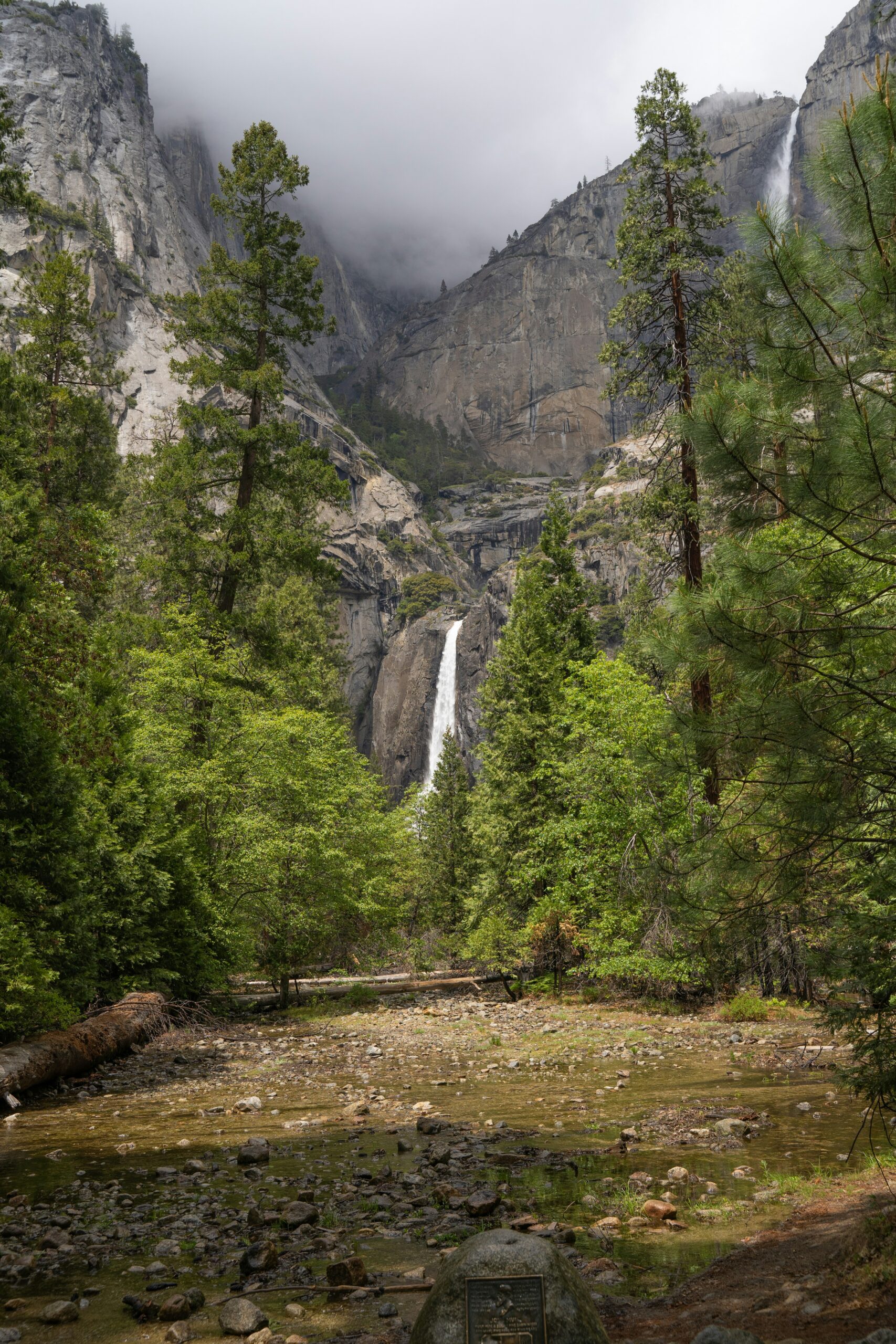
Some of these falls sit a hundred yards from a parking lot. Others demand a few miles of steep switchbacks and a real plan for heat, snow, or tide. Matching the right waterfall to your route, fitness level, and the season you're traveling in makes the difference between a rewarding stop and a wasted drive.
This list groups the best waterfalls in Northern California by region, from the Shasta-Cascade loop near Redding and Mount Shasta, through Yosemite National Park and Lake Tahoe, out to the coast and Lassen Volcanic National Park. Along the way, I'll flag which spots work for a quick roadside stop, which ones reward a longer hike, and where access is restricted or unsafe no matter how good the photos look online.
Northern California Waterfalls: 25+ Best Falls & Hikes
Shasta-Cascade Stops Near Redding and Mount Shasta
The Shasta-Cascade region north of Redding holds one of the densest clusters of waterfalls in the state, strung along a loop that runs from Burney to Mount Shasta and back. Shasta County sits on volcanic bedrock laced with underground springs, which means several of these falls run cold and clear even in late summer, fed by aquifers rather than surface runoff.
Burney Falls and Lake Britton
Burney Falls drops 129 feet inside McArthur-Burney Falls Memorial State Park, and it runs at nearly full volume all year because it's spring-fed rather than snowmelt-dependent. Burney Creek feeds the falls before it empties into Lake Britton, where a swim beach and boat launch give families a place to cool off after the short paved trail to the viewing area. The park sits about an hour northeast of Redding, and the loop trail around the base takes most visitors under an hour.
The Three Tiers of McCloud Falls
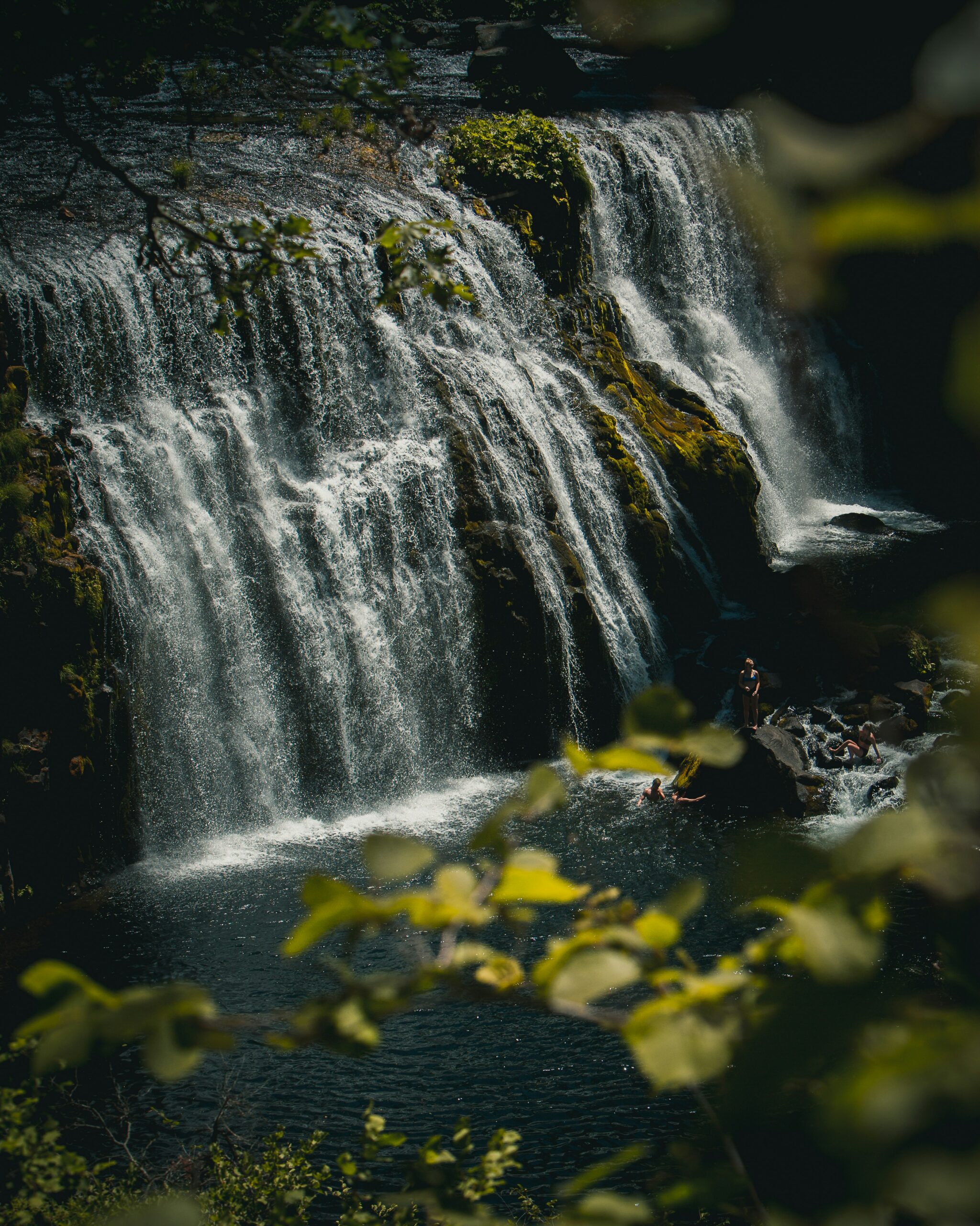
McCloud Falls is really three separate waterfalls strung along a single trail on the McCloud River, and I'd budget a half day to see all three. Lower Falls has an easy paved approach and a popular swimming hole below the plunge pool. Middle Falls is the showstopper, a wide 50-foot curtain that draws most of the crowd, while Upper Falls sits in a narrower basalt gorge with a smaller but more secluded pool. The full route between them runs through Shasta-Trinity National Forest and stays shaded most of the way, which helps in summer heat. The drive from Redding to the McCloud trailheads covers roughly 80 miles, a stretch Visit Redding highlights as one of the region's best single-day waterfall loops.
Hedge Creek Falls and Mossbrae Falls in Dunsmuir
Hedge Creek Falls sits inside the town of Dunsmuir and takes about ten minutes to reach on the Hedge Creek Falls Trail, ending at a cave behind the falling water where you can look out through the spray toward the Sacramento River canyon. It's one of the easiest true waterfall hikes in this guide, well suited to families or a quick stretch break on a Mount Shasta road trip.
Mossbrae Falls, a wide spring-fed cascade a short distance downstream, is a different story. The only traditional access route runs along active Union Pacific railroad tracks, and that approach is unauthorized and dangerous, not a sanctioned trail. Trespassing on active rail lines has caused injuries and deaths at waterfalls elsewhere in the state, and Mossbrae carries the same risk. Skip the tracks and view the falls from a boat on the Sacramento River or from permitted viewpoints when they're available, rather than treating this as a standard hike.
Whiskeytown Falls, Crystal Creek Falls, and Potem Falls
Whiskeytown Falls drops 220 feet inside Whiskeytown National Recreation Area, reached by a moderate 3.4-mile round-trip trail that climbs a concrete staircase into the mist near the top. It's the tallest waterfall in the park, and the National Park Service maintains the trail, which makes it one of the more reliably accessible destination hikes.
Crystal Creek Falls, also inside Whiskeytown, offers a flatter, easier walk that works well for visitors who want a waterfall payoff without the climb. Potem Falls, east of Redding near Lake Shasta and the Pit River, requires a short but steep unmaintained scramble down to the base, and the plunge pool draws swimmers on hot days despite uneven, slippery footing.
Nearby, Castle Crags State Park adds granite spires around Castle Dome, and side trails to Root Creek Falls and Mill Creek Falls near Ney Springs Canyon and the old Ney Springs Resort site give hikers a quieter alternative when the main loop gets crowded. Anyone building a longer Shasta itinerary around these stops might also enjoy exploring more of the things to do in Mount Shasta beyond the waterfalls themselves.
Sierra, Yosemite, and Lake Tahoe Waterfall Hikes
Yosemite Valley and the Eastern Sierra hold some of the tallest and most photographed waterfalls in the country, and their flow depends heavily on snowpack, meaning late spring and early summer bring the biggest water. Lake Tahoe and the Sierra foothills near Oroville add granite-lined cascades and swimming holes that peak on a different schedule than the high country above them.
Yosemite Valley's Major Waterfalls
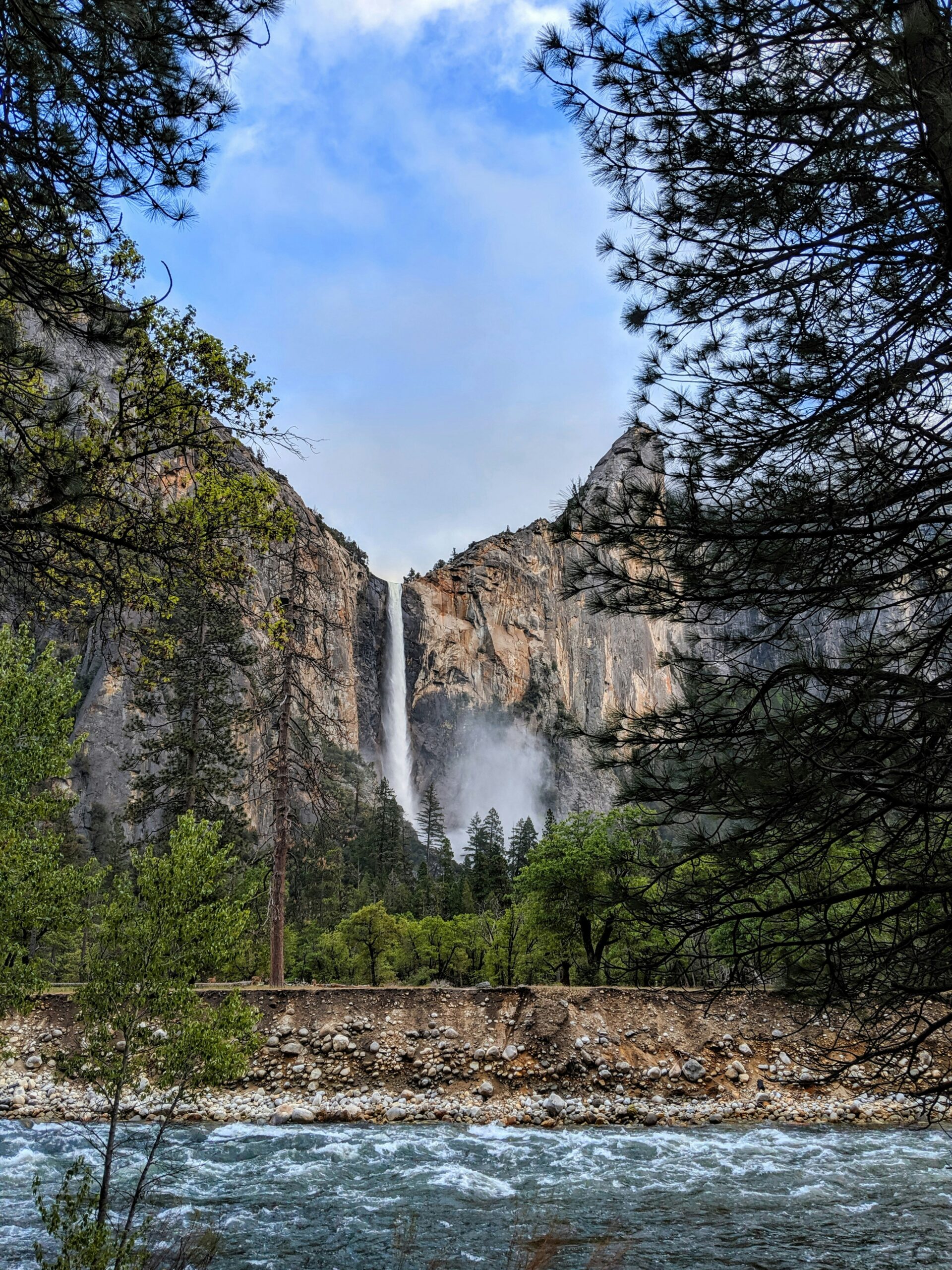
Yosemite Falls is the tallest waterfall in North America, and its Upper and Lower sections are both visible from easy paths near Yosemite Valley's main loop road. The Mist Trail climbs past Vernal Fall and continues to Nevada Fall, a strenuous route with granite steps that get slick with spray, running below landmarks like Half Dome, El Capitan, and Sentinel Rock. Bridalveil Fall sits at the valley's western end with a short paved walk, while Horsetail Falls near El Capitan only glows orange in mid-February light, a seasonal effect unrelated to summer flow. Glacier Point offers a distant overlook of several falls at once without any of the climbing.
Trail parking in Yosemite National Park and Yosemite Valley often requires timed reservations during peak season, a detail worth confirming with the park before driving up. Readers planning a longer stay can find more on Yosemite National Park's lesser-known corners beyond the valley floor.
Rainbow Falls and Devils Postpile Near Mammoth Lakes
Rainbow Falls drops 101 feet on the San Joaquin River inside Devils Postpile National Monument near Mammoth Lakes, and its name comes from the mist-born rainbow that appears in the spray during midday sun. The trail runs about 1.5 miles round trip and stays mostly flat, making it accessible for most hikers once the shuttle season opens. Lundy Canyon Falls, farther north in the Eastern Sierra, adds a quieter alternative with beaver ponds and aspen groves along the approach.
Lake Tahoe Cascades and Emerald Bay Viewpoints
Eagle Falls near Emerald Bay State Park is the most visited waterfall at Lake Tahoe, with a steep half-mile trail leading to views over Emerald Bay and Eagle Lake beyond. South Lake Tahoe also holds Glen Alpine Falls and the Bassi Falls area near Alpine Lake, both quieter options reached by dirt forest roads. Water levels at all three peak with snowmelt in May and June and thin out noticeably by August. Anyone planning a broader stay around the lake can pair a falls hike with more from this Lake Tahoe visitor guide.
Feather Falls, Phantom Falls, and the Foothills
Feather Falls, near Oroville in Plumas National Forest, ranks among the tallest waterfalls in California and drops over granite cliffs at the end of an 8.8-mile round-trip loop trail with a dedicated overlook platform. It's a full-day hike, not a quick stop, and the American River watershed below stays swollen well into early summer most years.
Phantom Falls, closer to Oroville on the Table Mountain plateau, flows seasonally over a basalt cliff and often disappears completely by mid-summer once the winter rains stop feeding it. Spring is the only reliable window for either Feather Falls' full volume or Phantom Falls' existence at all.
Coastal, Bay Area, and Volcanic-Area Escapes
Coastal and Bay Area waterfalls run on a rain-driven schedule that flips the usual Sierra pattern, peaking in winter and spring rather than summer, while Lassen Volcanic National Park adds a geothermal backdrop unlike anywhere else on this list. Point Reyes and Marin County give Bay Area residents a waterfall fix without a Sierra-length drive.
Alamere Falls and Wildcat Beach at Low Tide
Alamere Falls is a rare tidefall, dropping directly onto Wildcat Beach where the Pacific Ocean meets the sand inside Point Reyes National Seashore. The hike from the Palomarin trailhead runs roughly 8 miles round trip past Wildcat Campground, and timing matters: high tide can cut off safe passage along the beach approach, so checking tide tables before leaving home is essential. Winter and spring rain bring the fullest flow, while the falls can slow to a trickle by late summer.
Cataract Falls and Marin County Rainy-Day Walks
Cataract Falls on Mount Tamalpais offers a string of cascades along Cataract Creek, reached by a moderate trail through redwood and fir forest in Marin County. Winter storms turn this into one of the most dependable rainy-season hikes in the Bay Area, since the creek responds quickly to rainfall and drops off fast once storms pass. It works well as a half-day trip for anyone based in San Francisco or the East Bay.
Kings Creek Falls and Lassen Volcanic National Park
Kings Creek Falls tumbles through a volcanic gorge inside Lassen Volcanic National Park, reached by a moderate 2.3-mile round-trip trail that passes meadows below Lassen Peak. The park's geothermal areas, including Bumpass Hell, sit within driving distance and pair naturally with a falls visit for a full day of volcanic scenery. Faery Falls, near Mount Shasta's base, offers a smaller spring-fed alternative for travelers connecting this region back to the Shasta-Cascade loop.
When to Go and How to Plan a Safe Visit
Late spring gives the most reliable water flow across nearly every waterfall on this list, though the exact window shifts by region and water source. Snowmelt-fed falls in the Sierra Nevada and Yosemite National Park peak in May and June, spring-fed falls like Burney Falls stay strong year-round, and coastal falls like Alamere Falls run fullest in winter and early spring rain.
Which Season Has the Best Water Flow?
Sierra waterfalls fed by snowpack, including Yosemite Falls, Vernal Fall, and Feather Falls, hit peak volume in late May through June as the high country melts off. By late August, many of these same falls thin dramatically or stop entirely, as is the case with Phantom Falls near Oroville. Spring-fed falls like Burney Falls and the McCloud Falls trio stay closer to full volume through summer and fall since they draw from underground aquifers rather than surface snowmelt. Coastal falls like Alamere Falls and Cataract Falls run opposite the Sierra pattern, peaking with winter storms and fading by summer.
Where Can You Swim Safely?
Lower McCloud Falls and the pool below Burney Falls on Lake Britton offer some of the more established swimming spots in the region, but currents near any waterfall base can be stronger and colder than they look from shore. Rocks below falls on the Pit River and Sacramento River are frequently slick with algae, and submerged logs or sudden drop-offs are common at plunge pools. Swimming near a waterfall's base carries real risk even at popular, well-visited spots, and cliff jumping has caused serious injuries at several Northern California waterfalls, including some on this list. Check for posted warnings and avoid swimming alone in unfamiliar water.
What Should You Check Before Leaving Home?
A short pre-trip checklist saves wasted drives and avoids real hazards:
- Fire restrictions and forest closures, especially in Shasta-Trinity and Plumas National Forests during summer and fall
- Tide tables for any coastal hike near the Pacific Ocean, particularly the Alamere Falls route
- Snow conditions on Sierra trailhead access roads through late spring
- Timed entry or parking reservations for Yosemite Valley
- Current trail status and any closures posted by the managing park or forest service before starting a hike
Waterfall trails change condition fast in Northern California, and a quick check the morning of your trip beats finding a locked gate or a closed road after a two-hour drive.


