Highway 1 Closed in Big Sur: Timber Fire Closure & Latest Updates
Highway 1 closed in Big Sur again as the Timber Fire continues burning through Monterey County, forcing Cal Fire and the California Highway Patrol to shut down the corridor to protect crews and the public.
The closure runs from just south of Old Coast Road at mile marker 50.1 to just south of Deetjens Big Sur Inn at mile marker 42.6, effective Thursday at 1:00 p.m., with no set reopening date.
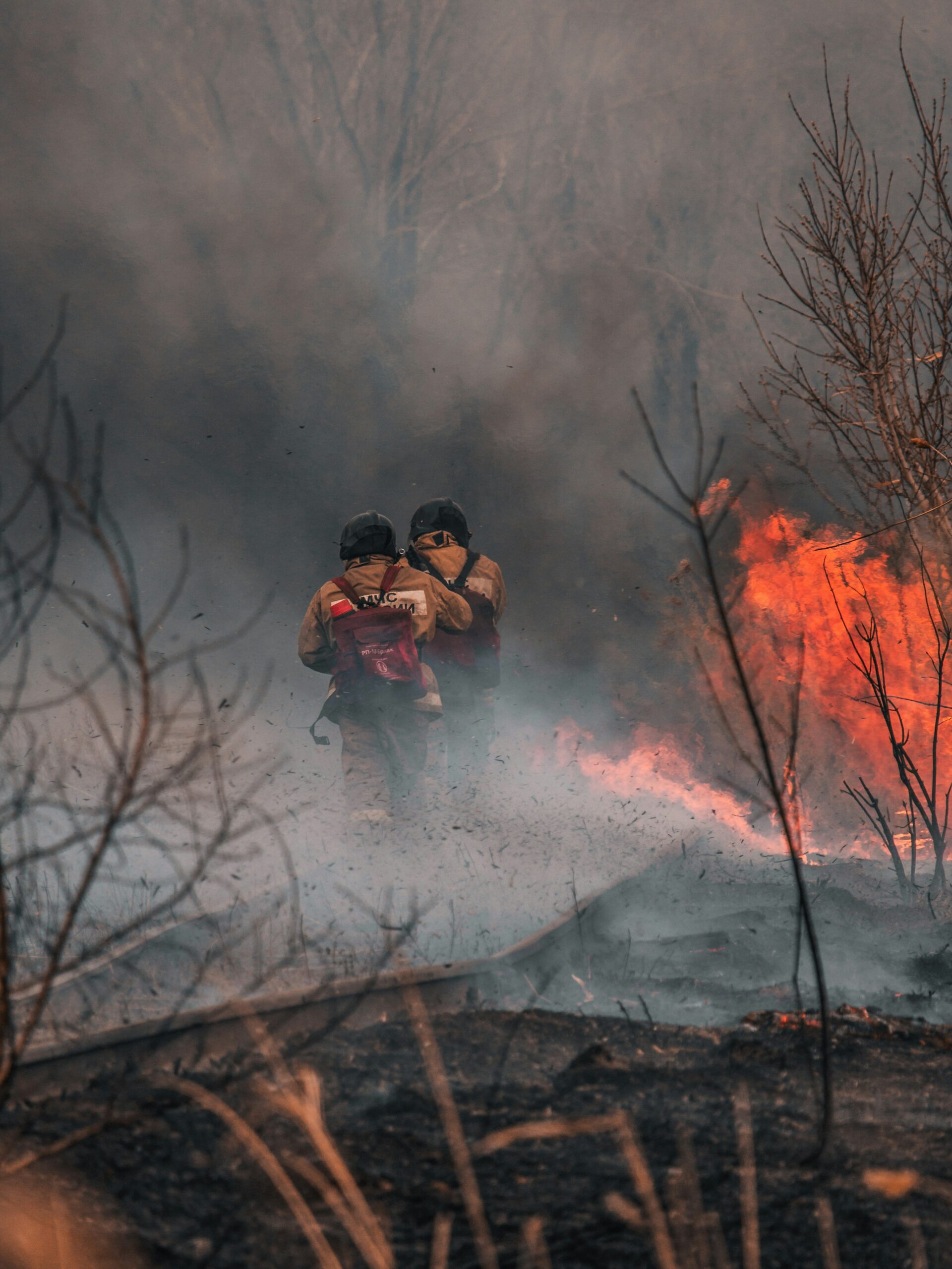
The move follows a brief reopening earlier in the week and comes as the fire has grown to nearly 19,300 acres.
The Timber Fire, which started August 8, has become one of the largest wildfires in California this year, according to Cal Fire.
Hot, dry conditions and low humidity have driven fire behavior across the Ventana Wilderness, pushing flames toward Ventana Double Cone and the upper Carmel River basin while crews work to hold containment lines near Coast Ridge Road and Pico Blanco Camp.
A second fire, the Plaskett Fire, ignited nearby on Wednesday, adding pressure on firefighting resources already stretched across the region.
The California Department of Forestry and Fire Protection reports containment at 21 percent as of Thursday, with evacuation orders and warnings shifting as fire activity changes along the northern and eastern flanks.
Updated Sept 3rd, 2026: The closure is from mile marker 19 at the Kirk Creek Campground down to mile marker 0.0 at the Monterey/San Luis Obispo County line.Travelers are currently not able to drive through Big Sur, and are advised to use Route 101 if traveling north from southern California and use Hwy One South from Monterey and Carmel.
Highway 1 Closed in Big Sur: Timber Fire Closure & Latest Updates
Current Road Status and Travel Impacts
An eight-mile section of Highway 1 shut down at 1 p.m. on August 27 to support active firefighting operations against the Timber Fire, forcing travelers to reroute through US 101.
Businesses, parks, and residents throughout Big Sur are contending with a second round of disruptions after the highway had briefly reopened earlier in the month.
Closure Limits, Timing, and Reopening Conditions
The current closure spans from Post Mile 42.6, roughly half a mile south of Deetjen's Big Sur Inn, to Post Mile 50 near Andrew Molera State Park.
Caltrans District 5 confirmed the hard closure took effect Thursday afternoon to allow crews to focus on evacuation routes and containment lines without civilian traffic interference.
No firm reopening date has been announced.
The timeline depends entirely on fire behavior and containment progress, which officials continue to monitor daily.
This marks the second closure of the corridor in less than a month.
Highway 1 had reopened after a 12-day shutdown tied to the same fire before conditions worsened again.
Caltrans Safety Inspections and Highway Access
Caltrans crews are coordinating closely with fire command staff to determine when inspection teams can safely assess the roadway.
Sections near active burn areas require clearance from fire officials before engineers can check for heat damage, debris, or slope instability.
Electronic message boards are posted along the corridor to warn drivers before they reach the closure point.
Caltrans has directed all through-traffic to use US 101 as the primary detour.
Travelers can track conditions through official channels:
- Caltrans Central Coast District 5 on X (@CaltransD5)
- Facebook page for Caltrans Central Coast (District 5)
- Instagram account Caltrans_D5
Local monitoring groups, including Big Sur Fire's incident updates, also provide real-time information on containment and access.
Affected Parks, Businesses, and Visitor Destinations
The closure directly affects access to Andrew Molera State Park, which sits at the northern boundary of the shutdown zone.
Depending on containment progress, Pfeiffer Big Sur State Park and Julia Pfeiffer Burns State Park may also face intermittent access restrictions if the fire perimeter shifts.
Businesses within the closure area, including the community of Fernwood, are reporting steep drops in visitor traffic.
Local operators have urged tourists to avoid unnecessary travel to the region until conditions stabilize.
Popular destinations such as Nepenthe restaurant and the Henry Miller Memorial Library remain in limbo, with hours and access shifting based on daily fire updates.
Visitors planning trips to Big Sur are advised to confirm operating status directly with individual businesses before departing.
Fire Size, Location, and Containment Operations
The Timber Fire has grown to nearly 19,000 acres across steep, remote terrain in the Los Padres National Forest, with crews working multiple fronts to hold established lines.
Hot, dry conditions and low humidity continue to shape fire behavior and complicate suppression efforts.
Acreage, Containment, and Areas of Active Growth
The fire has burned 19,296 acres as of the latest update, making it the third largest fire in California this year.
Active growth continues on the northwest side, where flames have crossed Ventana Creek and are moving uphill through the Lion Creek drainage toward Ventana Double Cone and the upper Carmel River basin.
The fire is expected to back downhill into the Little Sur drainage next, where spread should slow.
To the east, fire activity continues near the North and South Forks of the Big Sur River and through the South Fork drainage.
Crews are also working near Pico Blanco Camp, Bottcher Gap, and Kincannon Road.
Why Terrain and Weather Are Driving Fire Behavior
Rugged terrain across the fire zone limits direct ground access, forcing crews to rely on natural barriers and prepared lines rather than close-in attack in many areas.
Dry conditions have kept fuel moisture critically low, and relative humidity has fallen into the single digits at upper elevations.
Temperatures near 90°F add to the fire's intensity.
The marine layer has played a role too.
When compressed, it traps smoke near the ground overnight; once it lifts around midday, rising warm air draws down drier, windier conditions from above.
This process clears smoke but also pushes stronger winds toward the fireline, often accelerating fire activity through the afternoon.
Aircraft, Ground Crews, and Strategic Firing Work
Aircraft support has remained heavy, with six Type 1 helicopters, four Type 2 helicopters, and three Type 3 helicopters conducting water drops alongside a mobile retardant base.
Uncrewed aerial systems now assist both day and night operations.
On the ground, firefighters working with the U.S. Forest Service continue building and reinforcing control line in areas like Coast Ridge Road, Bottcher Gap, and near Memorial Campground, while also protecting sensitive cultural resources.
Crews are preparing for firing operations, including backburn work along Coast Ridge Road, to remove unburned vegetation ahead of the fire's edge.
This reduces fuel available to the main fire and helps hold containment lines as conditions allow.
Evacuations, Safety Guidance, and Official Updates
Evacuation orders and warnings remain in place across multiple zones in the area affected by the Timber Fire, with the situation subject to change as containment efforts continue.
Residents and travelers are advised to follow guidance from local authorities rather than rely on secondhand reports.
Active Evacuation Orders and Warning Zones
The Monterey County Sheriff's Office maintains authority over evacuation orders and warnings tied to the Timber Fire's expanding footprint.
Multiple zone designations remain under active orders or warnings, including MRY-D078, MRY-D082, MRY-D084, MRY-D085, MRY-D086, MRY-D088, MRY-D089, MRY-D090, and MRY-D091.
Additional zones carry warning status rather than mandatory orders, among them MRY-F015-B, MRY-F015-C, MRY-F028-B, MRY-F030-A, MRY-F030-B, MRY-F031-A, MRY-F031-B, MRY-F032-A, and MRY-F032-B.
An evacuation warning signals that conditions could deteriorate quickly, and residents in these zones should be ready to leave without delay.
Zone boundaries and statuses shift as fire behavior changes.
A zone listed as a warning one day may escalate to a mandatory order the next, particularly if wind or terrain pushes the fire toward populated areas.
Shelter-in-Place Requirements and Preparedness
Residents in warning zones are expected to prepare an evacuation kit and have a clear exit route identified in advance.
This includes essential documents, medications, and supplies for pets or livestock, since evacuation notices can arrive with little warning.
Those under mandatory evacuation orders must leave the designated zone immediately; sheltering in place is not authorized in these areas.
Staying behind in an active order zone can also put first responders at risk, since crews may need to conduct welfare checks or rescues during active fire operations.
Households near Andrew Molera State Park and Deetjen's Big Sur Inn should pay close attention to updates, given the road closures affecting access in that corridor.
Anyone with mobility limitations or medical needs should arrange transportation early rather than waiting for a mandatory order.
Where Residents and Travelers Can Verify Changes
The Monterey County Sheriff's Office issues official evacuation updates through its emergency notification channels. Residents should register for alerts if they have not already done so.
Zone-specific status changes are posted as they occur. There is no fixed schedule for these updates.
Caltrans District 5 provides road closure updates relevant to evacuation routes. This includes changes to Highway 1 access points.
Their social media accounts on X, Facebook, and Instagram are updated frequently during active fire operations.
CAL FIRE and the U.S. Forest Service also publish containment and status reports tied to the Timber Fire's jurisdiction and response.