California Bucket List: 60 Must-See Places & Hidden Gems
I've lived in California my whole life, and people still ask me the same question every summer: where do I even start? The state stretches over 800 miles from the Oregon border to Mexico, and no two regions look, feel, or taste the same.
A California bucket list has to work like a menu, not a checklist you race through in one trip. You pick what fits your time and your interests, then you go deep instead of wide. The best trips I've taken here picked one or two regions and lingered, rather than trying to cram redwoods, desert, and Disneyland into ten exhausting days.
This rundown covers 60 stops across the Golden State, organized by region so you can build a route that actually makes sense on a map. Some are famous. Some you won't find on the postcards. All of them are worth the drive.
California Bucket List: 60 Must-See Places & Hidden Gems
How to Build a California Trip That Fits Your Time
The single biggest planning mistake I see is trying to touch every corner of California in one visit. This state is roughly the size of Italy and Germany combined, and the drive from the redwoods of Northern California to the deserts near the Mexican border takes far longer than most first-timers expect. Build a trip around one or two regions, pick a season that matches the landscape you want, and lock in reservations early for anything popular.
Choose One or Two Regions Instead of Trying to See It All
I break California into five travel regions: Northern California, Central California, the Sierra Nevada, the deserts, and Southern California. Trying to hit all five in a week means eight-hour driving days and blurry memories.
Pick one region and go deep, or pair two that sit close together. San Francisco and Sonoma County work well together. Monterey and Big Sur do too. A California travel plan built around regions, not a single sprawling itinerary, tends to produce a trip people actually enjoy.
How Many Days Do You Need for California's Top Experiences?
Seven days covers one region well or a fast coastal loop between San Francisco and Los Angeles. Ten days allows a relaxed Pacific Coast Highway run with real time in Big Sur. Fourteen days is the sweet spot for pairing the coast with wine country or a national park, and three weeks opens the door to the Sierra Nevada and desert parks on top of everything else.
| Trip Length | Realistic Scope |
|---|---|
| 7 days | One region, or a fast SF-to-LA coastal loop |
| 10 days | Full Pacific Coast Highway, SF to LA |
| 14 days | Coast plus wine country or one national park |
| 21 days | Coast, cities, and Sierra Nevada or desert parks |
When Is the Best Time to Visit Each Landscape?
Every part of California runs on its own calendar. The coast stays mild and foggy in summer, while the Sierra Nevada only fully opens once mountain passes clear of snow, typically by early summer.
- Spring (March-May): wildflowers, green hills, but snow can linger on high Sierra trails
- Summer (June-August): warm inland deserts and mountains, but coastal fog and the biggest crowds
- Fall (September-November): clear skies, thinner crowds, and wine country harvest season
- Winter (December-February): whale watching season and quiet roads, but Sierra passes can close with snow
I plan around shoulder seasons whenever I can. Late May and late September deliver the best mix of good weather and manageable crowds.
Road-Trip Logistics, Reservations, and Entry Requirements
A rental car is essential for nearly every California itinerary outside San Francisco's walkable core. Flying into one city and out of another (San Francisco in, Los Angeles out, for example) saves you from backtracking on a coastal drive.
International visitors from certain countries need to apply for entry authorization through the ESTA program before arrival, and it's worth sorting that out weeks ahead, not the night before your flight. Book any popular park reservations early too, since rules and permit systems for spots like Yosemite change from year to year.
The Pacific Coast Highway, also called Highway 1, is the backbone connecting Northern and Central California. Stretches near Big Sur have no cell signal and limited services, so fill your tank and download offline maps before you go.
Northern California's Wild Coasts, Redwoods, and Wine Country
Northern California rewards travelers who love fog-draped coastline, ancient trees, and unhurried wine tasting more than theme parks and crowds. This region stretches from the Oregon border down through San Francisco, and it moves at a slower, quieter pace than the south.
Walk Among Redwoods on the Avenue of the Giants
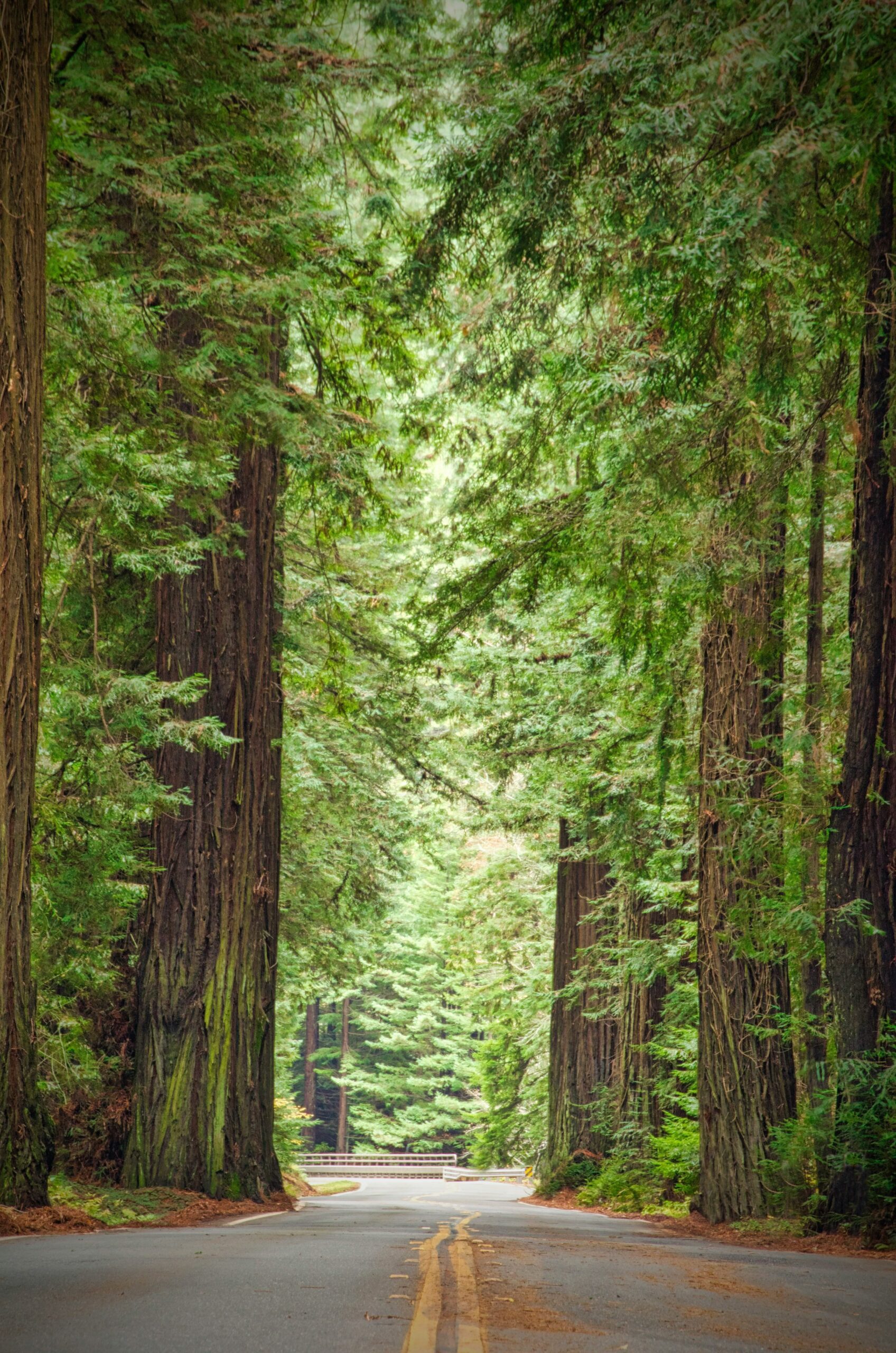
The Avenue of the Giants is a 31-mile stretch of old Highway 101 that winds through Humboldt Redwoods State Park, and driving it feels like entering a cathedral built by nature. Redwood trees here rise well over 300 feet, and pulling over to walk one of the short groves off the road is worth every extra hour it adds to your day.
Give yourself at least half a day. Stopping at Founders Grove or Rockefeller Forest lets you stand at the base of trees older than most nations.
Explore Fern Canyon, Glass Beach, and the Mendocino Coast
Fern Canyon, tucked inside Prairie Creek Redwoods State Park, has fifty-foot walls covered in ferns that make it look prehistoric, and it genuinely was a filming location for that reason. Glass Beach near Fort Bragg is a strange, beautiful counterpoint: decades of dumped glass have washed into smooth, colorful pebbles that glitter at the waterline.
Mendocino itself is a small coastal town with weathered wooden buildings perched above bluffs. I'd budget two or three days to link these three spots along the coast without rushing.
See Burney Falls and Lassen Volcanic National Park
Burney Falls drops more than 100 feet into a pool ringed by moss and ferns, and it stays cold and misty even in the height of summer. Lassen Volcanic National Park, less than two hours away, holds boiling mud pots, steam vents, and a still-active volcanic peak.
Both sit far enough inland that most coastal travelers skip them, which keeps the crowds thin. Late summer and early fall offer the clearest access to trails.
Watch Wildlife at Point Reyes and Tomales Bay
Point Reyes National Seashore is one of the best wildlife-watching spots in the state. Elephant seals haul out on the beaches near the Point Reyes Lighthouse in winter, and whale watching along the outer coast peaks from December through April as gray whales migrate past.
Tomales Bay, just inland, is famous for its oyster farms and calm kayaking water. The nearby Cypress Tree Tunnel, a canopy of wind-bent trees leading toward the lighthouse, is one of the most photographed short walks in Northern California.
Go Wine Tasting in Sonoma and Napa Valley
Sonoma County and Napa Valley sit less than 90 minutes north of San Francisco, making them the easiest wine country add-on to any Bay Area trip. Napa leans polished, with well-known estates around Yountville, while Sonoma County tends to feel more relaxed and less crowded on weekdays.
Fall harvest season, roughly September through October, is when both regions come alive with activity. Book tastings ahead on weekends, since popular wineries fill up fast.
Experience San Francisco Beyond the Golden Gate Bridge
San Francisco offers far more than a photo at the Golden Gate Bridge. Alcatraz Island tours sell out days in advance and are worth booking before you land, since walking through the old cell blocks overlooking the San Francisco Bay is one of the city's most memorable stops.
Muir Woods, just across the bridge, puts you among old-growth redwoods less than an hour from downtown. Sacramento, the state capital, makes a solid day trip inland, and no San Francisco visit feels complete without a late-night bowl of ramen in the Japantown or Richmond districts.
Central California's Classic Coastal Drive
Central California is where the Pacific Coast Highway earns its reputation, threading between ocean cliffs and mountain slopes for nearly 200 miles. This stretch between the Bay Area and Los Angeles rewards drivers who resist the urge to rush.
Follow Highway 1 From Monterey to Big Sur
Highway 1 from Monterey to Big Sur is the drive people picture when they imagine California. Twenty-six miles south of Carmel, the road clings to cliffs above the Pacific Ocean, crossing the famous Bixby Creek Bridge along the way.
Give yourself a full day for a stretch that could technically be driven in two hours. Pullouts appear constantly, and every one of them tempts you to stop.
See the Monterey Bay Aquarium and Santa Cruz Beach Boardwalk
The Monterey Bay Aquarium sits right on the water in Monterey Bay and holds one of the best kelp forest exhibits I've seen anywhere. Santa Cruz, about 45 minutes north, has the Santa Cruz Beach Boardwalk, home to the Giant Dipper, a wooden roller coaster that's been running since 1924.
Pair these two on the same day if you're short on time. Both sit close enough together to fit into one relaxed afternoon and evening.
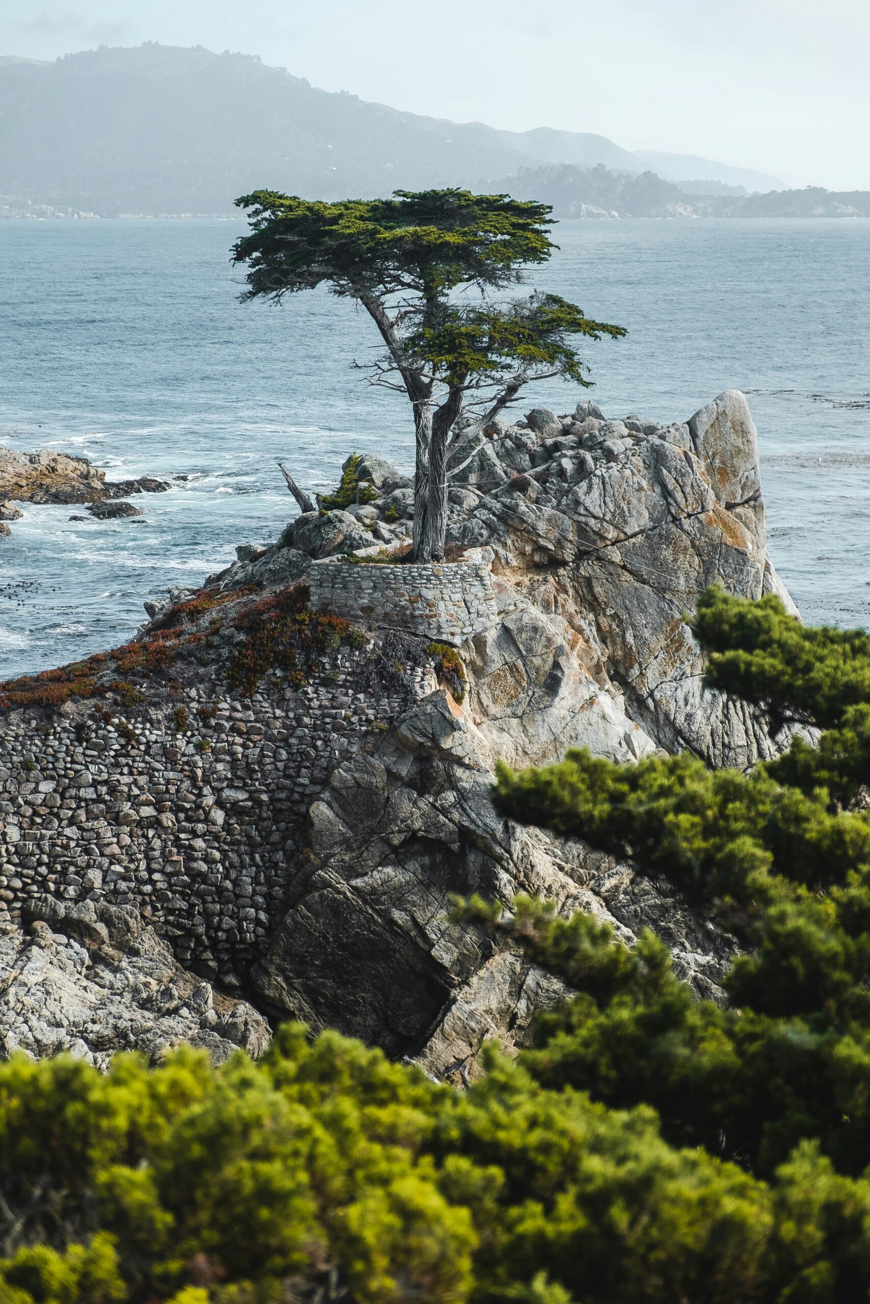
Drive 17-Mile Drive Through Pebble Beach and Carmel
The 17-Mile Drive loops through Pebble Beach's coastal cypress groves and famous golf courses, with ocean views around nearly every bend. It connects easily to Carmel-by-the-Sea, a walkable town of cottage-style shops and quiet beaches just south of Monterey.
I'd plan an hour and a half for the drive itself, plus time to wander Carmel on foot afterward.
Stop for McWay Falls, Hearst Castle, and Elephant Seals
McWay Falls, inside Big Sur, drops 80 feet straight onto a beach that's almost impossible to reach on foot, so most people view it from an overlook just off the highway. Hearst Castle near San Simeon shows the extravagant side of California history, with tours through rooms filled with imported art and antiques.
Just north of the castle, a colony of elephant seals hauls out on the sand near San Simeon nearly year-round, and pupping season in winter draws the biggest crowds.
Slow Down in San Luis Obispo, Solvang, and Santa Barbara
San Luis Obispo makes a comfortable overnight stop between Big Sur and Santa Barbara, with an easy downtown built around a historic mission. Solvang, a Danish-founded town inland, stands out for half-timbered buildings and bakeries that feel imported from Denmark.
Santa Barbara closes out this stretch with Spanish-style architecture, palm-lined streets, and a beach setting that feels more relaxed than Los Angeles just two hours south.
Visit Pinnacles National Park and California Missions
Pinnacles National Park, inland from the coastal route, protects towering rock spires formed by an ancient volcano and gives hikers a shot at spotting California condors overhead. It's one of the least crowded national parks in the state.
California's historic missions, scattered along this corridor from Carmel to Santa Barbara, trace the state's Spanish colonial history and often sit right in the middle of the towns you're already passing through.
Sierra Nevada Peaks, Giant Trees, and Alpine Lakes
The Sierra Nevada delivers California's biggest mountain scenery, and it demands more planning than the coast because roads and trails depend heavily on snowmelt. This range runs more than 400 miles through the eastern side of the state, and it holds some of the tallest peaks in the contiguous United States.
See Yosemite Valley, Half Dome, and Glacier Point
Yosemite National Park is the headline stop in the Sierra Nevada, and Yosemite Valley is where nearly everyone starts. Half Dome towers over the valley floor, while Glacier Point offers one of the best overlooks in the park without requiring a summit hike.
Waterfalls run highest in late spring as snow melts. Summer opens the high country once Tioga Road clears of snow, usually by early summer.
Meet General Sherman in Sequoia and Kings Canyon
Sequoia and Kings Canyon National Parks sit a few hours south of Yosemite and protect groves of giant sequoias, the largest trees on Earth by volume. The General Sherman Tree is the biggest of them all, and standing at its base puts the scale of these forests into perspective fast.
Pairing Yosemite with Sequoia and Kings Canyon on the same trip makes sense geographically and lets you compare two very different forest ecosystems in a matter of days.
Make Lake Tahoe and Emerald Bay a Four-Season Stop
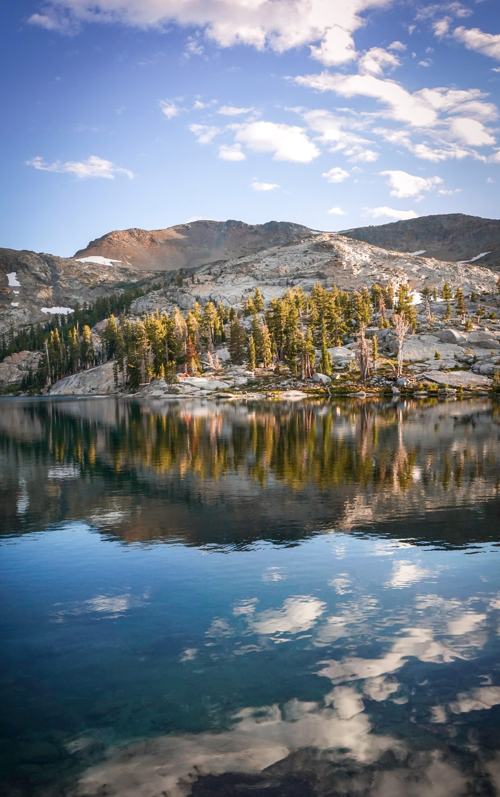
Lake Tahoe works as a destination in every season, with skiing in winter and clear, cold swimming in summer. Emerald Bay, on the lake's southwest shore, delivers the postcard view most people picture, deep blue water framed by granite peaks, and it's often called a bucket-list staple.
Summer and winter both draw heavy crowds, so weekday visits stretch your options.
Take Highway 395 Through Mammoth Lakes and the Eastern Sierra
Highway 395 runs along the eastern edge of the Sierra Nevada and connects a string of underrated stops, including Mammoth Lakes and the ski slopes of Mammoth Mountain. The Eastern Sierra feels drier and starker than the western slope, with jagged peaks rising straight out of the desert floor.
This route works well as a link between Yosemite and the desert parks farther south, especially if you're driving a longer Sierra-to-desert loop.
Desert Landscapes That Feel Like Another Planet
California's deserts hold some of the strangest, starkest scenery in the state, with salt flats, boulder fields, and colors that shift dramatically with the light. Death Valley and Joshua Tree anchor this region, and both reward visitors who plan around the heat rather than fight it.
Walk the Salt Flats at Badwater Basin
Badwater Basin, inside Death Valley National Park, sits 282 feet below sea level and holds a crust of white salt flats that stretch to the horizon. Walking out onto the salt polygons feels like stepping onto a dry lakebed on another world.
Visit in early morning or late afternoon. Summer temperatures here regularly become dangerous by midday.
Find Zabriskie Point and Death Valley's Extreme Vistas
Zabriskie Point overlooks a maze of golden and rust-colored badlands that glow hardest at sunrise. Death Valley National Park holds the title of hottest and lowest point in the country, and that extremity is exactly why photographers chase this spot at dawn and dusk.
Fall through spring is the season to visit. Summer heat makes daytime exploring risky, even for short walks.
Stargaze Among Joshua Trees and Giant Boulders
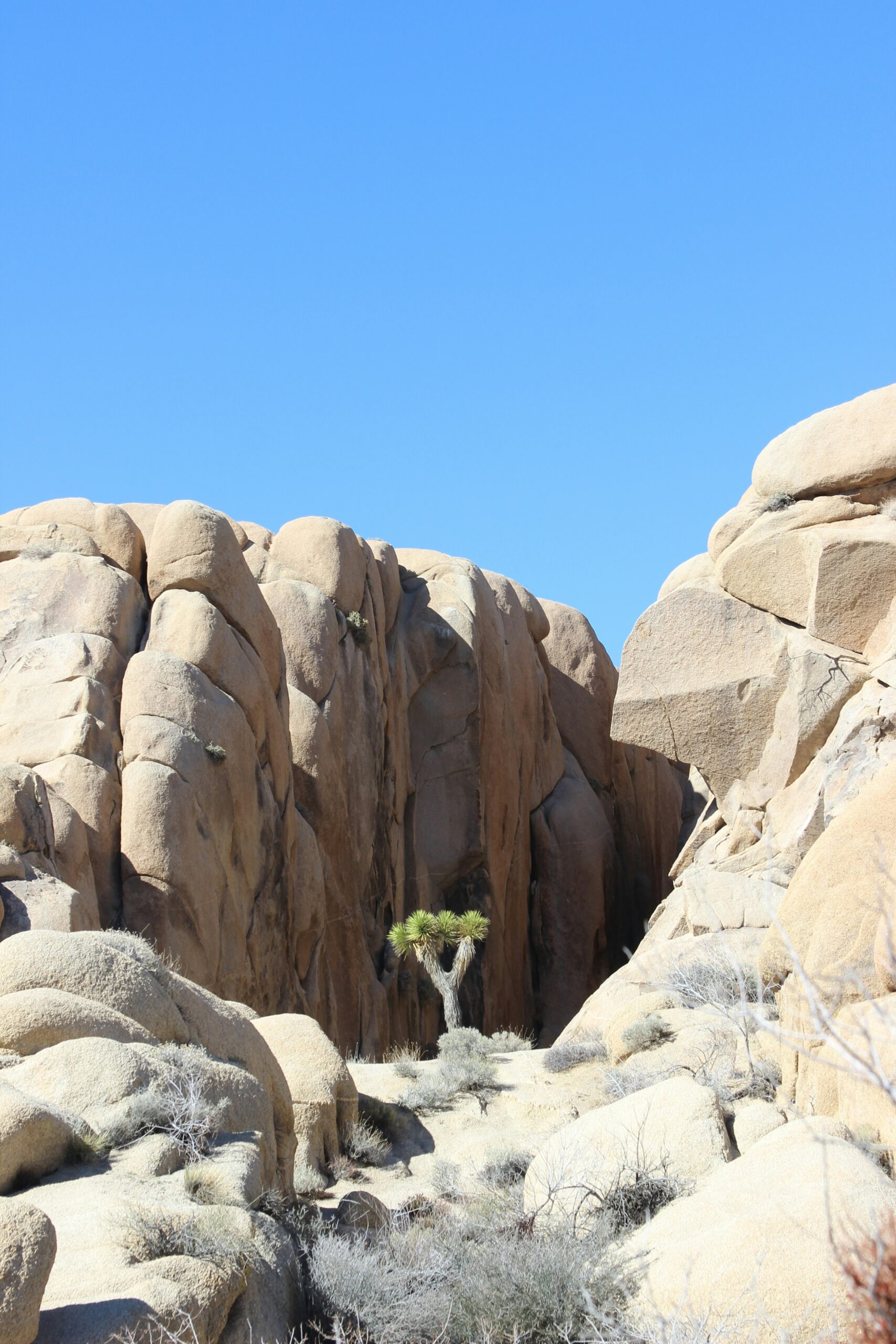
Joshua Tree National Park protects thousands of Joshua trees scattered among massive granite boulder piles, and its distance from city lights makes it one of the best stargazing spots in Southern California. Clear desert air and minimal light pollution turn the night sky into a dense field of stars most visitors rarely see at home.
Spring and fall bring the most comfortable daytime temperatures for hiking among the boulders.
Combine Palm Springs, Coachella, and Desert Art Stops
Palm Springs pairs naturally with Joshua Tree, sitting close enough for a same-day drive between midcentury architecture and desert wilderness. The Coachella Valley hosts the Coachella music festival each spring, drawing crowds that reshape the region's hotel prices for weeks.
Salvation Mountain, a hand-built hillside covered in folk-art murals near the Salton Sea, rewards travelers willing to add an extra hour of driving for something genuinely strange and personal.
Southern California's Cities, Beaches, and Islands
Southern California packs the state's biggest cities, most famous theme parks, and some of its best beaches into a stretch you can drive in a day. Los Angeles anchors the north end of this region, San Diego anchors the south, and Orange County's beach towns fill the gap between them.
See Los Angeles From the Hollywood Sign to Griffith Observatory
The Hollywood Sign is best viewed from a hiking trail above it or from Griffith Observatory, which also gives you sweeping views over the Los Angeles basin. Griffith Observatory sits inside Griffith Park and offers free telescope viewing on clear nights, which is a detail a lot of first-timers miss.
Los Angeles sprawls, so plan your days around neighborhoods rather than trying to zigzag across the city.
Choose Between Universal Studios Hollywood and Disneyland
Universal Studios Hollywood sits inside Los Angeles and leans into movie-themed rides and behind-the-scenes tram tours. Disneyland, in Orange County, is the original Disney park and draws families chasing classic rides and characters.
| Feature | Universal Studios Hollywood | Disneyland |
|---|---|---|
| Location | Los Angeles | Anaheim, Orange County |
| Theme | Movies and TV | Classic Disney and fantasy |
| Best for | Teens, film fans | Families, younger kids |
| Nearby pairing | Hollywood, Griffith Observatory | Beach towns, Knott's Berry Farm |
Picking one over the other usually comes down to age of your group and how much time you have left for the beach.
Spend a Beach Day at Santa Monica, Venice, or Laguna
Santa Monica Pier anchors one of the most recognizable beach scenes in Southern California, with an amusement park built right onto the pier itself. Venice Beach, just south, draws a livelier, artsier crowd along its boardwalk and canals.
Laguna Beach, further south in Orange County, trades the boardwalk energy for quieter coves and cliffside views. Each beach has its own personality, so match your pick to whether you want people-watching or a calmer stretch of sand.
Explore Balboa Park, La Jolla Cove, and the San Diego Zoo
Balboa Park in San Diego holds more than a dozen museums and gardens inside one sprawling green space, and the San Diego Zoo sits right inside it. La Jolla Cove, a short drive away, is where you'll find sea lions lounging on the rocks just steps from the water.
San Diego moves at a calmer pace than Los Angeles, and its reliable sunshine makes it an easy add-on to a Southern California itinerary.
Take the Ferry to Catalina Island or Channel Islands
Catalina Island sits about an hour off the coast by ferry from Long Beach or San Pedro, and it feels like a small Mediterranean town dropped into the Pacific. Golf carts replace most cars in the town of Avalon, and snorkeling in the clear water off the island is a highlight for a lot of first-time visitors.
Channel Islands National Park, farther north near Ventura, offers a wilder, less developed alternative with sea caves and hiking trails that see far fewer visitors than Catalina.