The Ultimate Redwood National Park Road Trip: Best Stops Between Eureka and Crescent City
The drive from Eureka to Crescent City covers roughly 80 miles of Northern California coastline, and it happens to run straight through Redwood National and State Parks. I’ve mapped out the stops that matter most, from Fern Canyon‘s fern-covered walls to the ancient groves along Howland Hill Road, so you can see the tallest trees on earth without wasting a single mile.
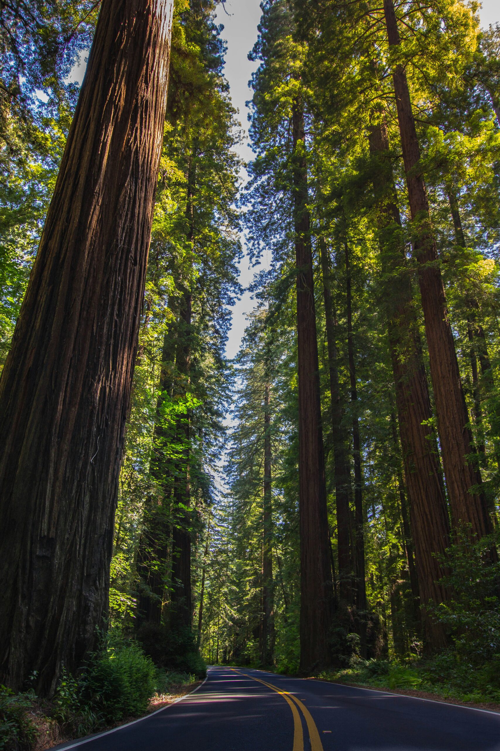
This stretch of highway doesn’t really announce itself the way some national parks do. There are no big entrance gates here—just old-growth redwoods that sneak up on you until suddenly you’re surrounded. I’ve driven this route enough to know which turnoffs are worth the detour, like the Newton B. Drury Scenic Parkway and the Klamath River Overlook, and which ones you can skip if you’re short on time.
Redwood National Park and its connected state parks all blend together, so the best sights aren’t always where you’d expect. Elk Meadow, Trillium Falls, and the Coastal Drive each have their own vibe, and I’ll walk through how to fit them into a single trip. I want this to be a practical plan for a California redwoods road trip so you can spend less time staring at your GPS and more time under the trees.
The Ultimate Redwood National Park Road Trip: Best Stops Between Eureka and Crescent City
Route Overview and Essential Planning
Driving from Eureka to Crescent City along Highway 101 covers roughly 90 miles of the Northern California coast, and I map out the distance, timing, seasonal factors, lodging, and packing details I rely on before setting out.
Driving Direction, Distance, and Ideal Trip Length
I head north on Highway 101 from Eureka through Arcata, Orick, and Klamath before rolling into Crescent City near the Oregon border.
The direct distance is about 90 miles, but I never treat this as a quick highway run.
With detours onto the Newton B. Drury Scenic Parkway, Howland Hill Road, and the Coastal Drive, I set aside at least a full day.
If I want to hike Fern Canyon, visit Trillium Falls, and stop at the Klamath River Overlook without rushing, I block out two to three days.
A 4-day itinerary feels about right if I want to slow down at each major stop.
Best Seasons, Road Conditions, and Required Reservations
I visit in late spring through early fall for the driest roads and clearest coastal views.
Winter can bring heavy rain and landslides, closing unpaved sections like Howland Hill Road or Cal-Barrel Road.
Before I go, I check the park’s current conditions and road closures since GPS likes to bail on me in this region.
I also confirm my permit for Fern Canyon parking, which is required from May 1 to September 30 and needs to be booked ahead.
Some routes, including the Coastal Drive Loop, have one-way sections you’ll want to plan around before you get there.
Where to Stay: Eureka, Arcata, Orick, Klamath, and Crescent City
I pick my base depending on which stops I want closest.
- Eureka: hotels and restaurants, good starting point
- Arcata: smaller, near Humboldt Bay, quieter option
- Orick: closest to Fern Canyon, Elk Meadow, and Trillium Falls
- Klamath: near the Klamath River Overlook and Coastal Drive
- Crescent City: closest to Howland Hill Road and the Oregon border
I’ve stayed overnight in Orick and Klamath when I wanted early access to trailheads before crowds show up.
Camping works at Elk Prairie and Gold Bluffs Beach campgrounds if I want to stay inside the park itself.
What to Pack and How to Travel Responsibly
I always pack layers, since coastal fog and inland sun can feel like different seasons in the same day.
Sturdy hiking shoes make a big difference on muddy trails like Fern Canyon.
Binoculars are a must for wildlife viewing—Roosevelt elk and black bears show up along Bald Hills Road and Elk Meadow more often than you’d think.
I stick to Leave No Trace principles: pack out trash, stay on marked trails, and give wildlife their space.
Feeding animals or messing with the plants? I don’t do it. These forests recover slowly, so I try not to leave a mark.
Southern Stops From Eureka to Prairie Creek
I like to break up the drive north from Eureka with a handful of stops that show off the coast, the elk, and the redwoods before I reach the deeper forest sections of the park.
Trinidad, Sue-meg State Park, and Pacific Coast Views
Trinidad is one of my first stops, a small coastal town with easy access to bluff-top views of the Pacific Coast. I like walking down to Trinidad State Beach, where I can watch fishing boats come in and out of the small harbor.
A few miles north, I head over to Sue-meg State Park (used to be Patrick’s Point). The short coastal hikes here are great, especially the loop trail circling the headlands.
The tide pools at Sue-meg are worth a look at low tide. Sea lions sprawl on the offshore rocks, and seabirds work the cliffs above.
Elk Meadow and Roosevelt Elk Viewing
North of Trinidad, I pull over at Elk Meadow, just outside Orick. This open meadow is one of the most reliable places I know for spotting Roosevelt elk grazing in the grass.
I try to show up early morning or late afternoon, when the elk seem most active. The Davison Road exit near Elk Meadow also leads toward Gold Bluffs Beach, so sometimes I combine both stops.
I keep my distance from the elk—they’re wild and unpredictable, especially during rutting season in the fall.
Newton B. Drury Scenic Parkway and Big Tree Wayside
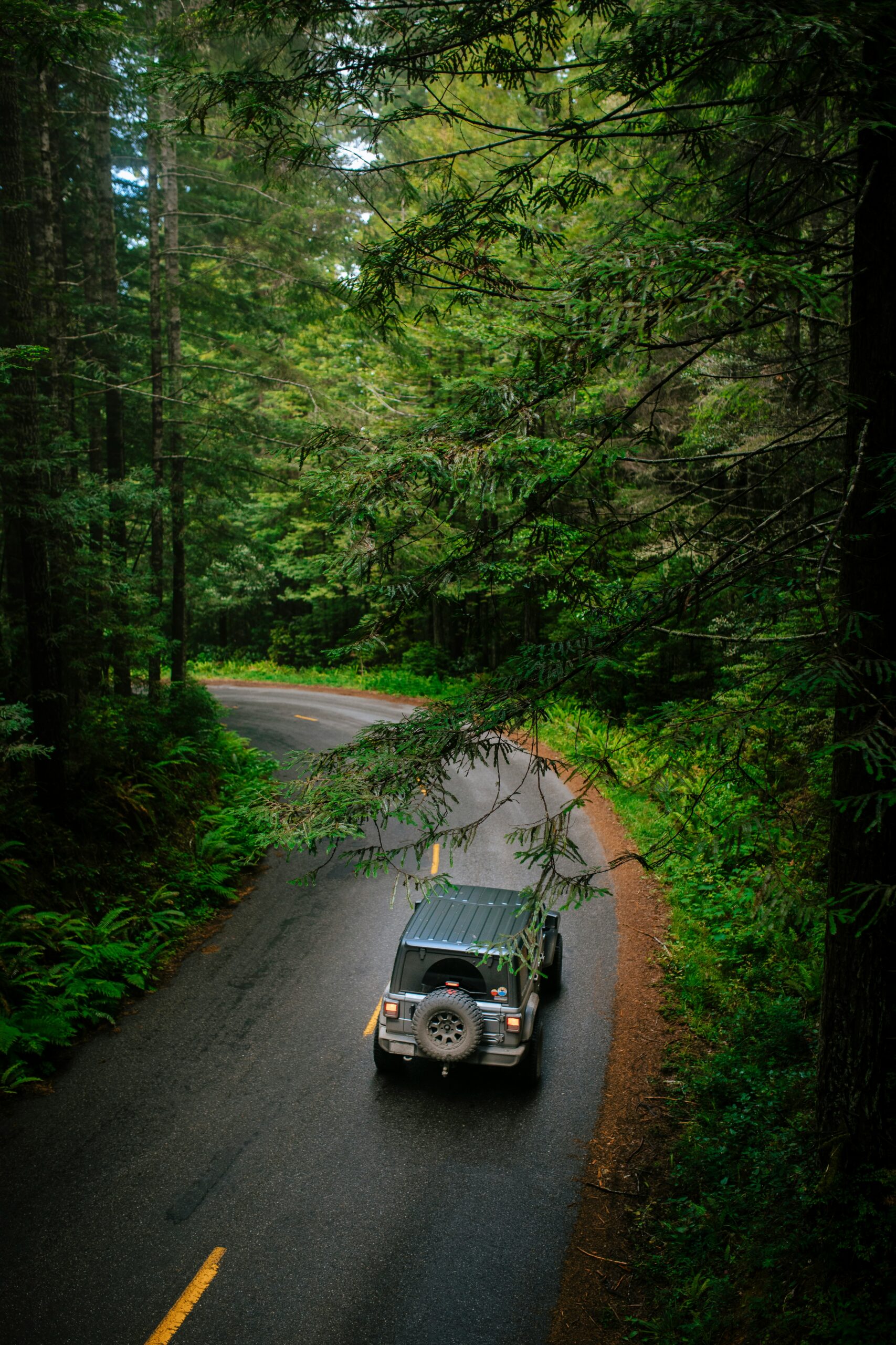
From Elk Meadow, I turn onto the Newton B. Drury Scenic Parkway, a paved alternative to US-101 that runs through Prairie Creek Redwoods State Park. The drive covers about ten miles and usually takes me twenty to thirty minutes if I’m not stopping.
I always pull over at Big Tree Wayside, home to one of the park’s largest and most photographed redwoods. It’s an easy, flat walk from the parking area—doesn’t take long to check it out.
Along the parkway, I pass the Prairie Creek Visitor Center and some trailheads I’ll sometimes explore if I have extra time.
Fern Canyon and Gold Bluffs Beach
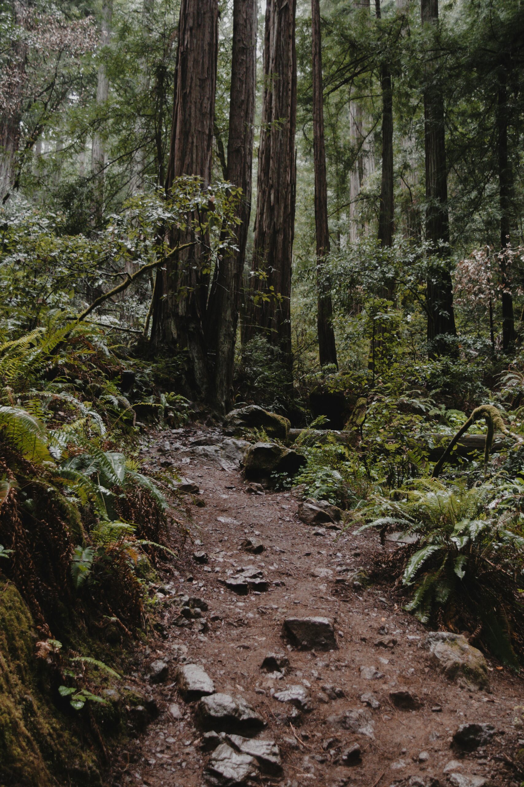
My last stop in this section is Fern Canyon, reached by driving the unpaved Davison Road to Gold Bluffs Beach. The canyon’s walls rise about 30 feet high and are covered in ferns—a scene right out of Jurassic Park, honestly.
I walk along the creek bed through the canyon, sometimes hopping across on small logs or rocks. Gold Bluffs Beach is right there, so I’ll wander the sand before or after the canyon walk.
I make sure to check current permit requirements before heading out, since Fern Canyon access is limited during peak season.
Northern Groves, River Views, and Coastal Detours
The northern half of this drive between Eureka and Crescent City winds through old-growth forest, river valleys, and stretches of open coastline. Each stop adds a different layer to the landscape, from short forest walks to unpaved backroads through some of the tallest trees on Earth.
Trillium Falls and Lady Bird Johnson Grove
I start with Trillium Falls, a short loop trail that winds through dense fern understory and crosses a small wooden bridge near the waterfall itself.
The trail is manageable, around 2.6 miles round trip, and I usually finish it in under two hours.
Nearby, I stop at Lady Bird Johnson Grove, a one-mile loop dedicated in 1969 that takes me through mature redwood stands without much elevation change.
Both sites sit within Redwood National Park, and I treat them as an easy morning combination before heading further north.
I find the grove especially quiet on weekday mornings, with light filtering through the canopy in a way that photographs well.
Klamath River Overlook and Coastal Drive
From the Trillium area, I drive toward the town of Klamath, where the Klamath River meets the Pacific Ocean.
The Klamath River Overlook gives me a wide view of the river mouth and coastline, and I often spot migrating whales from this point during the right season.
From there, I pick up the Coastal Drive, a narrow, winding road that traces the bluffs above the ocean.
This stretch is unpaved in spots, so I slow down and watch for other vehicles on tight curves.
I stop at a few pullouts along the way, since the ocean views here might be the best on this whole route along the park’s coastal edge.
Del Norte Coast Redwoods and Hidden Beach
Continuing north, I pass through Del Norte Coast Redwoods State Park, one of the three state parks that make up the larger Redwood National and State Parks system.
The redwoods here grow close to the shoreline, which creates a mix of forest and ocean scenery you don’t really see elsewhere on the drive.
I make a quick detour to Hidden Beach, accessible by a short trail from a small parking area.
The beach is rocky, not sandy, but it’s a nice spot to stretch my legs and listen to the waves before getting back on the road.
I don’t usually spend more than 20 or 30 minutes here.
Howland Hill Road, Stout Grove, and the Smith River
Howland Hill Road is honestly one of my favorite detours along this route. It’s a narrow, unpaved road weaving through Jedediah Smith Redwoods State Park, and I end up creeping along at a slow pace just to take it all in.
The road drops you right at Stout Grove, where these massive coast redwoods rise along the Smith River’s edge.
I usually walk the short loop trail here. If I’m feeling ambitious or have a little extra time, I’ll head out on the Boy Scout Tree Trail, which dives even deeper into the old-growth forest.
The Smith River stays clear most of the year, and people flock here for summer swimming.
This whole stretch just feels slower and quieter than the main highway—kind of a relief, honestly.
Crescent City Landmarks and Final Stops
I wrap up the drive in Crescent City, where a handful of landmarks make for a satisfying finish.
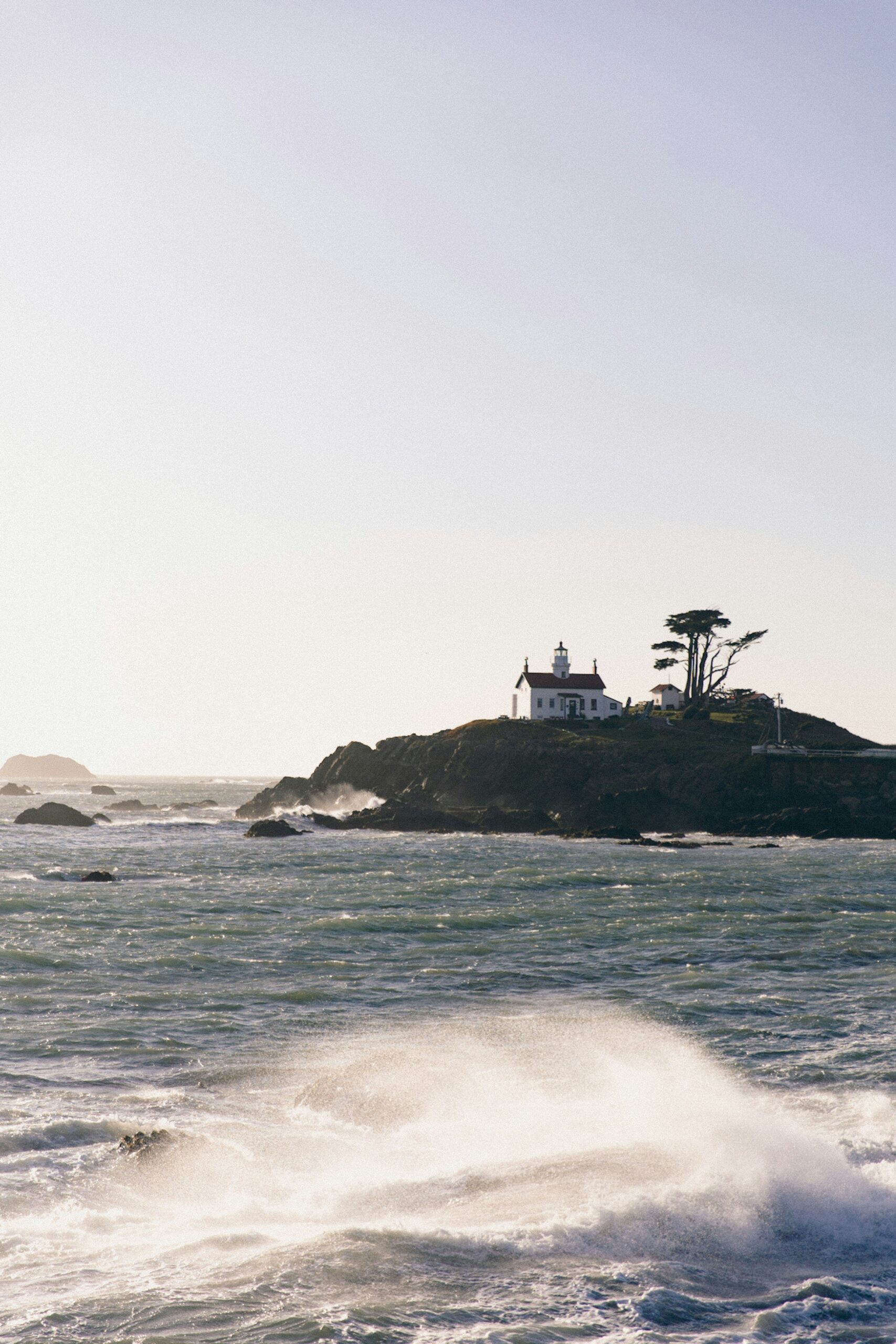
The Battery Point Lighthouse perches on a tiny island linked to town by a sandbar. You can only walk out there at low tide, so I always double-check tide charts before committing.
South Beach, just below downtown, gives me one last open sweep of coastline before I call it a day.
On my way in or out, I usually swing by Trees of Mystery—it’s got that giant Paul Bunyan statue out front and a gondola that glides up through the canopy.
The forest in this area gets compared to the forest moon of Endor from Star Wars: Return of the Jedi, since they filmed some of it nearby. I guess I can kind of see it.
Ways to Extend the Journey
If I’ve got a couple extra days to spare, I’ll stretch the trip in either direction—either more of California’s redwood coast or up into the Pacific Northwest.
Adding Humboldt Redwoods and the Avenue of the Giants
South of Eureka, I like to detour into Humboldt Redwoods State Park, home of the Avenue of the Giants. This 31-mile scenic route winds right alongside U.S. 101, threading through some of the tallest trees you’ll see anywhere.
I always make time for Founders Grove to check out the Founders Tree and the fallen Dyerville Giant. The Rockefeller Loop is a favorite too, twisting through one of the last big stands of old-growth redwoods.
The Eel River runs right by, and in summer I’ll stop for a quick wade or picnic. Near Fortuna, there’s Cheatham Grove, and if I’m up for a novelty, I’ll drive through one of those classic drive-thru trees—pretty cheesy, but fun once in a while.
Continuing North to the Oregon Coast
Once I pass Crescent City, the Oregon coast just keeps rolling, and the drives are honestly just as good. Highway 101 hugs the shoreline, winding through Brookings and Gold Beach with ocean views that don’t really quit.
If I’ve got the time, I’ll swing inland to Crater Lake—it’s about four hours from the coast—or keep heading north toward Washington’s Olympic National Park for a bigger, multi-day adventure. Both of those add a lot of driving, so I only tack them on if I can spare at least two or three days extra. Otherwise, I just end up wishing I’d slowed down more in the redwoods.
Extending South Toward San Francisco and Muir Woods
Heading south from Eureka, I wind my way toward San Francisco, jumping onto Highway 1 for the coastal stretch once I hit Mendocino County. Sure, this route crawls along compared to 101, but the cliffside views? Totally worth the extra time.
Just north of the city, I like to swing by Muir Woods National Monument for one last walk among old-growth redwoods before calling it a trip. The boardwalk trails force you to slow down, and honestly, the whole forest bathing thing feels less like a trend and more like a reset button in those dense, quiet groves.
After that, it's a quick hop over to the Golden Gate Bridge and into San Francisco. Feels like a natural endpoint for a longer California redwoods road trip, don't you think?

![14 Beachfront Coffee Shops: Best Coffee Shops With A View in California [2025 Guide]](https://californiabackroads.com/wp-content/uploads/2025/07/bennet-Ofn3-x6-B_A-unsplash-scaled.jpg)


