
Best Hikes in California: Epic Trails From Coast to Mountains
California's hiking options are almost overwhelming, but I've sifted through the noise to highlight the trails that actually stand out. The best hikes in California take you from the granite peaks of the Sierra Nevada to the foggy bluffs above the Pacific, through ancient redwood forests, across the Mojave's stark desert, and onto the volcanic slopes of the Cascade Range. No one region captures everything California offers, so I'm laying these hikes out by location.
I’ve also split things up by difficulty, scenery, and season, since picking the right trail isn’t just about where it is. A springtime waterfall stroll asks for different prep than a long Sierra backpack in August. National park trails get their own section too—Yosemite and Sequoia have their own quirky permit systems and seasonal rules.
If you’re craving a breezy coastal walk, a redwood ramble, or a tough summit, I’ve included the details that actually matter: mileage, elevation, permits, and timing. Hopefully that saves you some guesswork.
Best Hikes in California: Epic Trails From Coast to Mountains
California's Standout Trails at a Glance
These seven trails show off California’s whole spectrum: granite summits, waterfall-fed canyons, wild coastline, volcanic crags, and ancient forest—all within a day's drive of a city. I’ve grouped them by what sets each apart, from permits to timing.
Half Dome
The Half Dome hike in Yosemite National Park covers 14–16 miles round trip from Yosemite Valley, climbing about 4,800 feet. The last 400 feet up the granite face—using steel cables—makes this hike legendary.
You’ll need a permit for the cables, handed out by a preseason lottery in March and a daily lottery two days ahead. Rangers usually put up the cables from late May through early October, weather permitting.
Start before sunrise; most folks need 10–12 hours for the round trip. Summer afternoons bring real thunderstorm risk, and wet granite is genuinely dangerous.
Mist Trail to Vernal and Nevada Falls
The Mist Trail is the one I always suggest if you want Yosemite’s waterfalls but not the full Half Dome commitment. To Vernal Fall and back is 3 miles with 1,000 feet of gain; stretching to Nevada Fall makes it 5.4 miles and 1,900 feet.
April through June, both falls thunder with snowmelt, and the mist will absolutely soak you on the granite steps. No permit needed for a day hike.
The stone steps get slick even when dry, so I always wear shoes with real grip here.
Lost Coast Trail
The Lost Coast Trail runs 24 to 35 miles along Humboldt’s King Range, a wild stretch of coast so rough that Highway 1 detours inland. There’s no cell service or road access out there.
Tidal planning is crucial—some parts are only safe to cross within about two hours of low tide, so you’ll need a tide chart, no exceptions.
Overnight permits are required May 15 to September 15 for the northern section, and you have to carry a bear canister. I’d give yourself three or four days for the classic southbound trek.
Lassen Peak Trail
The Lassen Peak Trail climbs 5 miles round trip with nearly 2,000 feet of gain to the 10,457-foot summit of Lassen Peak, one of California’s few active volcanoes. Lassen erupted last in 1915, and you’ll cross volcanic rubble and leftover snow going up.
The trail is usually snow-free from late July through October, but early in the season I bring microspikes. No permit needed, but the parking lot fills up fast on weekends.
On a clear day, you can see deep into Oregon from the top.
Fern Canyon Trail
Fern Canyon sits inside Prairie Creek Redwoods State Park, and honestly, it’s a different world. Fifty-foot canyon walls draped in ferns rise up on both sides, and you’ll cross a creek a few times, usually balancing on wooden planks.
The loop is short—about a mile—so it’s doable for just about anyone. The road in can flood out in winter, so I’d aim for late spring through fall.
Mount Whitney
Mount Whitney, at 14,505 feet, tops the lower 48. The main route from Whitney Portal covers 22 miles round trip and climbs 6,100 feet. Permits are tough to get: the lottery is open Feb 1 to March 1 for the May–November season.
The last 1.9 miles above Trail Crest will test anyone, even if you’re fit. I start around 2 to 4am for a day hike to beat afternoon storms.
Bear canisters are mandatory if you’re camping, and rangers check at the trailhead.
Lands End Trail
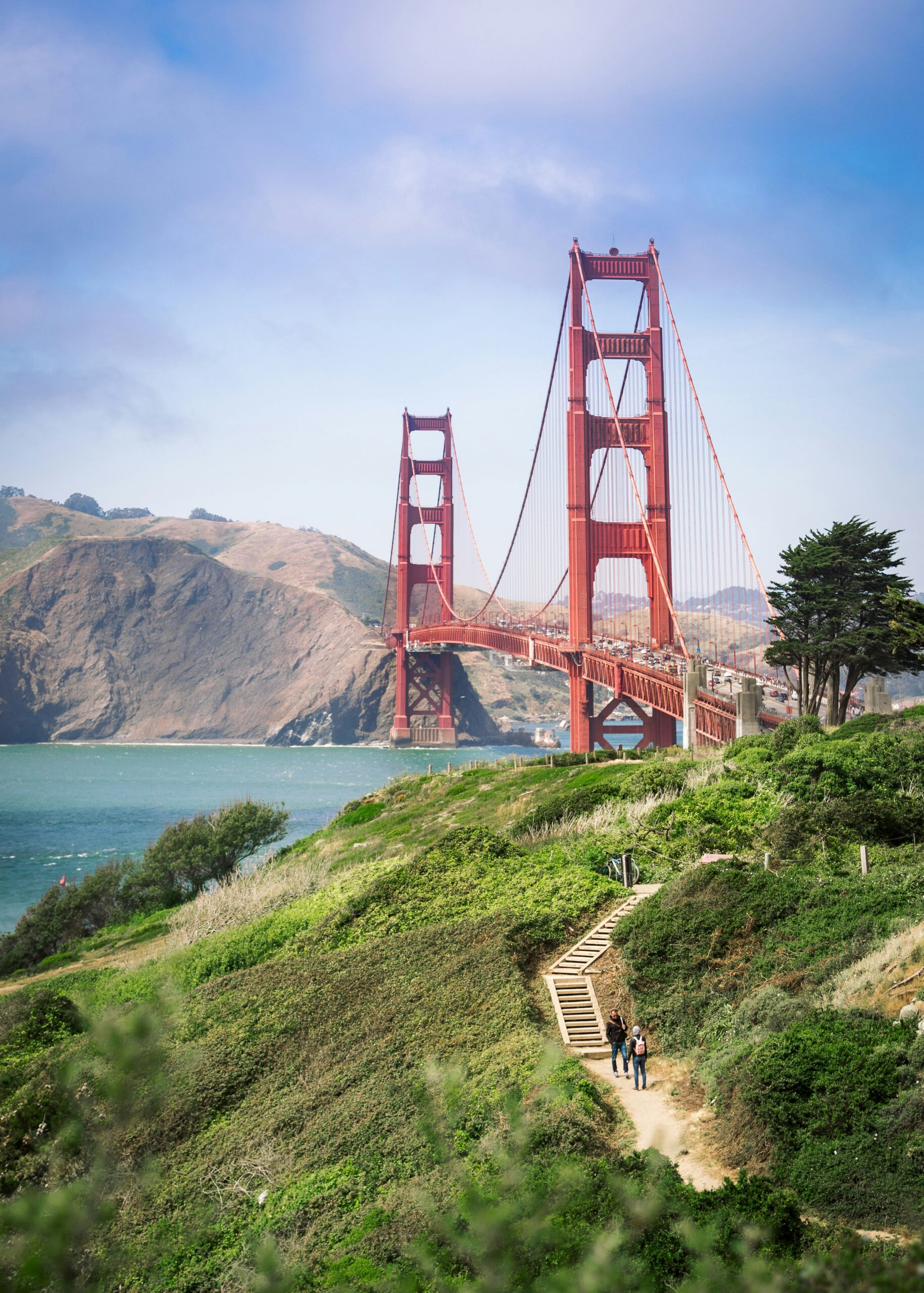
Lands End Trail hugs San Francisco’s northwest edge in the Golden Gate National Recreation Area, with sweeping views of the bridge and Marin Headlands. The main loop is about 3.4 miles with easy grades, so most folks can handle it.
No permit or fee needed, and you can get here by public transit from downtown. At low tide, you’ll spot old shipwrecks from the bluffs—always a cool bonus.
Explore California's Trails by Region
Each region in California asks for its own approach—gear, timing, even how you plan the day. Elevation and how close you are to the ocean affect everything from trail conditions to crowds, so I break it down by region instead of pretending the state’s just one big hiking spot.
Yosemite and the High Sierra
The High Sierra is, to me, the spine of California hiking. Yosemite Valley gets all the press, but I usually look to the John Muir Wilderness and Ansel Adams Wilderness for quieter granite basins and alpine lakes—fewer permits, more solitude.
The John Muir Trail runs 211 miles through all this. Plenty of people just do sections, not the whole thing. I use Big Pine as a launch point for the eastern Sierra, especially for Palisades trailheads.
Snow sticks around above 10,000 feet, sometimes into July, so I always check conditions before committing to a high route.
Lake Tahoe and the Eastern Sierra
Lake Tahoe gives me a different Sierra vibe—granite peaks around a massive alpine lake, not the deep valleys like Yosemite. I usually start from Tahoe City for easy access to trails along the west shore, where lake views open up quickly and you don’t have to climb as much.
Emerald Bay is the highlight for me. Emerald Bay State Park has trails down to Vikingsholm and the island, and it’s perfect if you want big scenery without burning a whole day.
The eastern Sierra past Tahoe stays cooler and drier, which means you can stretch the hiking season into early fall at higher trailheads.
Redwood Coast and Humboldt County
I head to Humboldt County for the old-growth redwoods you just can’t find anywhere else. Jedediah Smith Redwoods State Park and Prairie Creek protect trees that have been here longer than written history. I walk these trails slower, just to take it all in.
Fog rolls in almost daily from late spring through summer, and honestly, it just makes the groves feel more magical—keeps things cool and gives the light a soft, otherworldly quality.
Most trails here are shaded and low-elevation, so nearly anyone can enjoy them.
Bay Area and Point Reyes
San Francisco sits at the center of a dense hiking web. I rarely have to drive more than an hour for a great trail. The Marin Headlands give me bluff-top ocean views and old military ruins, all with the Golden Gate Bridge in sight.
North of the city, Point Reyes offers dramatic sea arches and wild coastline that I honestly think are some of the best day hikes in Northern California. Point Reyes National Seashore has a resident tule elk herd—I’ve seen them grazing right off the trail.
Winter rain can turn trails to mush, so I always check for closures between November and March.
Big Sur and the Central Coast
Big Sur is my go-to for hikes that mix real elevation with ocean views. Highway 1 winds through here, and most trailheads are right off the road—super easy even for a quick stop.
Redwood canyons give way to open bluffs, sometimes in just a mile or two. That contrast—dense forest, then boom, wide Pacific—is what makes Central Coast hiking feel so different from the Redwood Coast further north.
Fog is common on summer mornings, but it usually burns off by midday. I time my hikes for the afternoon if I want the views.
Southern California Mountains and Coast
Southern California isn’t just beaches and desert. The San Gabriel Mountains shoot up above LA, and I can be on a forested ridge within an hour of the city (traffic willing).
Closer to the ocean, the Santa Monica Mountains slice through the region, giving me chaparral ridges and sea views most people don’t expect. Down in San Diego, I find bluff trails and canyon hikes with a milder, steadier climate year-round.
Summer heat is no joke—even the coast can get pretty toasty from June to September, so I start early or stick to cooler days.
Desert and Volcanic Landscapes
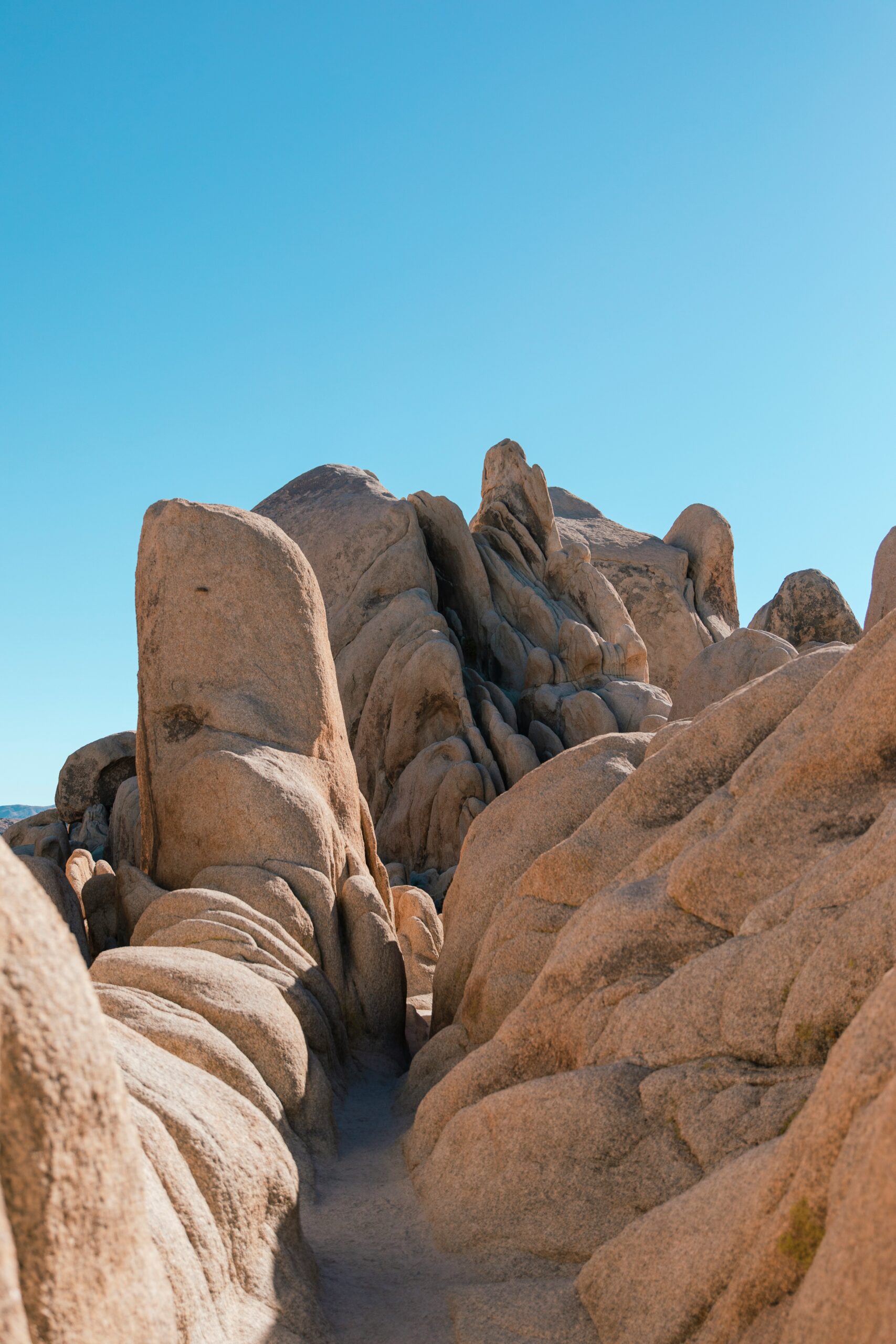
When I want desert, I split my time between two parks. Joshua Tree National Park has wild rock piles and its namesake trees, while Death Valley pushes things to the extreme—lowest, hottest, driest. I only hike there at dawn or in winter.
Further north, everything changes. Lassen Volcanic National Park still bubbles from its 1915 eruption, and Mount Shasta looms as a massive, glaciated peak you can spot for miles.
When I want granite spires and alpine lakes but not the Sierra crowds, I check out Castle Crags and the Trinity Alps.
Choose a Route for Your Experience Level
Matching a trail to my actual fitness and experience level, instead of just ambition, is what usually decides whether a hike feels rewarding or just exhausting. The routes below cover everything from paved coastal walks to multi-week wilderness traverses, so I can pick what fits my time, conditioning, and appetite for risk.
Easy Walks for Families and First-Time Hikers
Honestly, I think it's best to start with trails that offer scenery without any technical headaches. Torrey Pines in San Diego always gives me those classic sandstone bluffs and ocean views on smooth, well-graded paths—perfect for kids and anyone just easing into hiking.
Fern Canyon near Gold Bluffs Beach in Redwood National Park is another one I always mention. The canyon walls are just draped in ferns, and the walk is flat, following a creek bed with a couple of log crossings tossed in.
The Beach Trail down to Gold Bluffs Beach adds an easy coastal stretch, which I’ll sometimes pair with Fern Canyon for a mellow half-day. No permits needed, no special gear beyond sturdy shoes, and I can finish any of these in under two hours, usually with time to spare.
Moderate Day Hikes With Big Payoffs
Once I’ve got a little hiking fitness, I start looking for routes with 1,000 to 2,000 feet of elevation gain and a solid payoff. Sandstone Peak via the Mishe Mokwa Trail in the Santa Monica Mountains is a loop I keep coming back to—it climbs through volcanic rock and tops out at the highest point in the range, with ocean views if the weather cooperates.
In the Sierra foothills, stretches of the Rubicon Trail near Lake Tahoe give me granite scenery and lake access without committing to an all-day slog. I also like using segments of the Tahoe Rim Trail as day hikes, since the full thing is a long-distance beast but the individual parts make for great moderate outings with forest and lake views.
Strenuous Summit Days and Long-Distance Routes
When I want a real challenge, I go for summit hikes with some serious elevation gain and exposure. Mount San Antonio—most folks call it Mount Baldy—is a favorite I’ve climbed via the Baldy Bowl Trail. It’s steep, loose in spots, and that last push to the 10,064-foot summit is no joke.
Mount San Jacinto is another big one, and I’ll sometimes cheat a little by taking the Palm Springs Aerial Tram to cut down the approach. Mount Whitney, starting from Whitney Portal, is the heavyweight: 22 miles round trip, over 6,000 feet of gain, a permit lottery, and altitude that messes with almost everyone. I don’t even think about Whitney without giving myself time to acclimatize.
Multi-Day Backpacking Adventures
When I’m craving a longer escape, I plan around California’s big trails. The Pacific Crest Trail and John Muir Trail both cross the Sierra Nevada, and I’ve used sections of each for backpacking trips without ever attempting the full length.
On the coast, the Lost Coast Trail through the King Range National Conservation Area is my go-to for a remote, three- to four-day adventure along wild shoreline. I have to plan around tide charts, not a set schedule. Just south, Sinkyone Wilderness State Park extends that rugged coastline with fewer people around. All of these require overnight permits, a bear canister, and some real navigation planning before I head out.
Find Hikes by Scenery and Natural Highlights
I sort California’s trails by the landscape features that keep me coming back: granite cliffs and waterfalls, wild coastline, redwood groves, alpine terrain, and desert rock formations. Each region has its own vibe, so I break down what I look for and where I find it.
Waterfall Trails and Granite Views
Yosemite Valley is my answer whenever someone asks about waterfalls and granite in the same hike. The Yosemite Falls Trail climbs relentlessly to the top of North America’s tallest waterfall, and the view straight down the falls is worth every switchback.
From Happy Isles, I’ll follow the Mist Trail past Vernal Fall and up to Nevada Fall. Both are among the park’s most photographed, and I get soaked from the spray during spring runoff—honestly, that’s half the fun.
For the big granite views, I like the Panorama Trail from Glacier Point back into the valley, passing Illilouette Fall on the way. Sentinel Dome and the classic view of El Capitan’s face are also on my list—no need to be a climber for either.
Pacific Coast Walks and Wildlife Viewing
Point Reyes gives me the widest range of coastal scenery in a single park. I’ll hike the Coast Trail toward Alamere Falls, a rare tidefall that drops right onto the beach. I always check the tides before heading out.
At Tomales Point, I walk among tule elk with Tomales Bay on one side and the open ocean on the other. Along the bluffs and rocky coves nearby, I spot harbor seals hauled out, and sometimes sea otters working the kelp beds offshore.
Up north, I’ve hiked stretches of the Lost Coast between Mattole Beach and Black Sands Beach, where there’s no road and the isolation is real. Closer to San Francisco, I like the Ridge Trail above the Sutro Baths ruins, with the Golden Gate Bridge off in the distance. Andrew Molera State Park is another favorite—I mix bluff-top trails with beach access for a quick coastal fix.
Ancient Redwood Groves and Fern-Filled Canyons
Jedediah Smith Redwoods State Park is where I go for the Boy Scout Tree Trail, an old-growth grove that gets me away from the crowded pullouts along Highway 101. The trees here are some of the tallest I’ve ever seen.
Fern Canyon, in Prairie Creek Redwoods State Park, is another stop I never skip. Fifty-foot canyon walls, all covered in ferns, line a narrow creek bed. The place looks straight out of Jurassic Park—and actually was, for what that’s worth.
I always wear sturdy boots since the creek crossings are frequent and the footing changes a lot with the season.
Alpine Lakes, Peaks, and Volcanic Terrain
Emerald Bay, on Lake Tahoe’s west shore, gives me alpine lake scenery without a long trek—standing on the trail above, looking down at the turquoise water, is always worth it. Sometimes I’ll drop down to Vikingsholm at lake level for a change of pace.
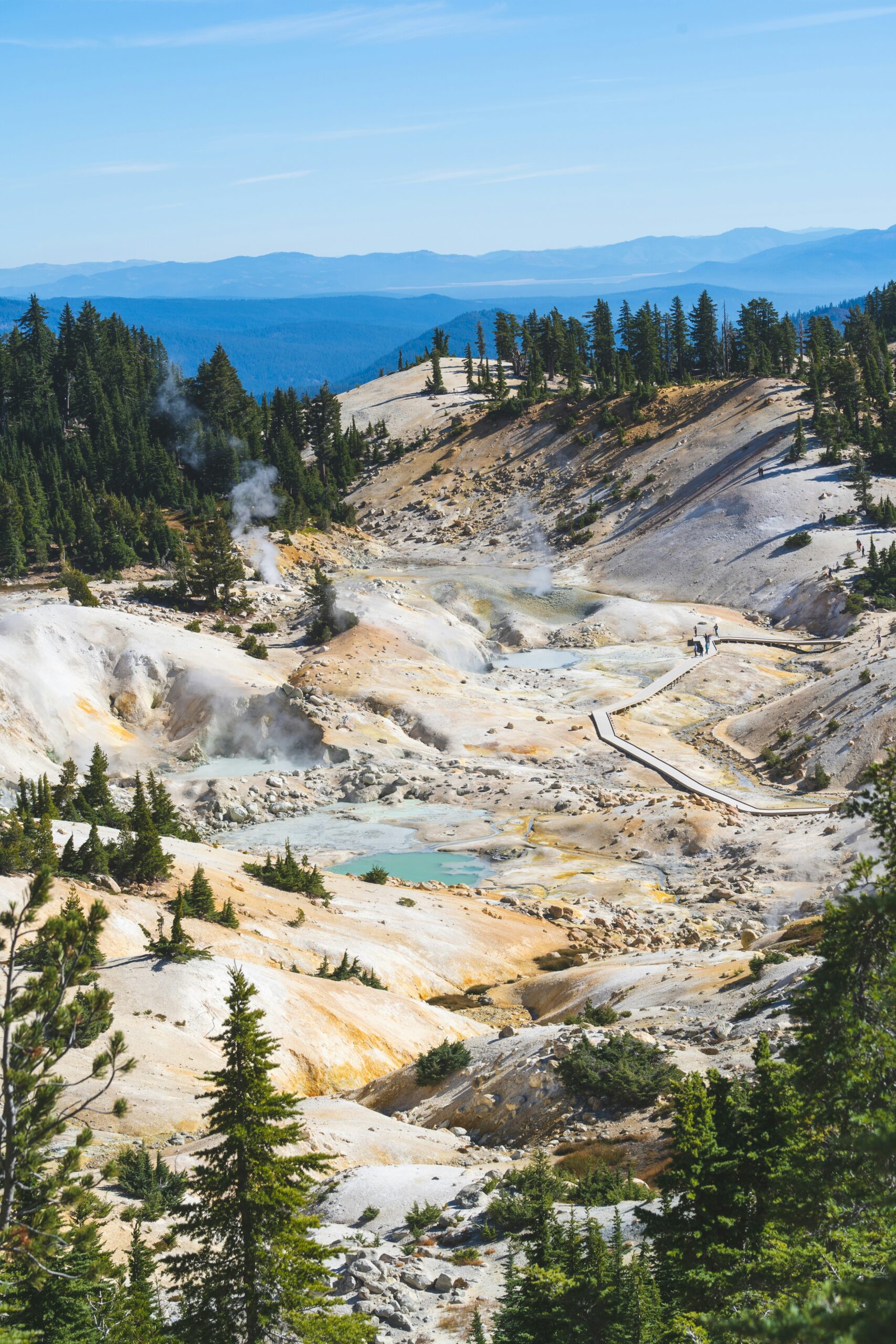
Further north, Lassen Volcanic National Park is my pick for a landscape that doesn’t feel like the rest of the Sierra. I’ll hike the Lassen Peak Trail to the 10,457-foot summit for Cascade Range views, then wander the boardwalk at Bumpass Hell to see boiling mud pots and fumaroles up close.
I stick to the boardwalk there—the ground crust over those hydrothermal features is thin, and testing it would be a bad idea.
Desert Oases and Otherworldly Rock Formations
Joshua Tree National Park is where I go to wander among the twisted trees and boulder piles that don’t look like anything else in California. I time these hikes for early mornings in the warmer months, because shade is in short supply out there.
In the Coachella Valley, I’ve hiked to groves of native California fan palms—always a wild sight in the middle of all that dry, rocky terrain. You know you’ve found a spring when you see those palms.
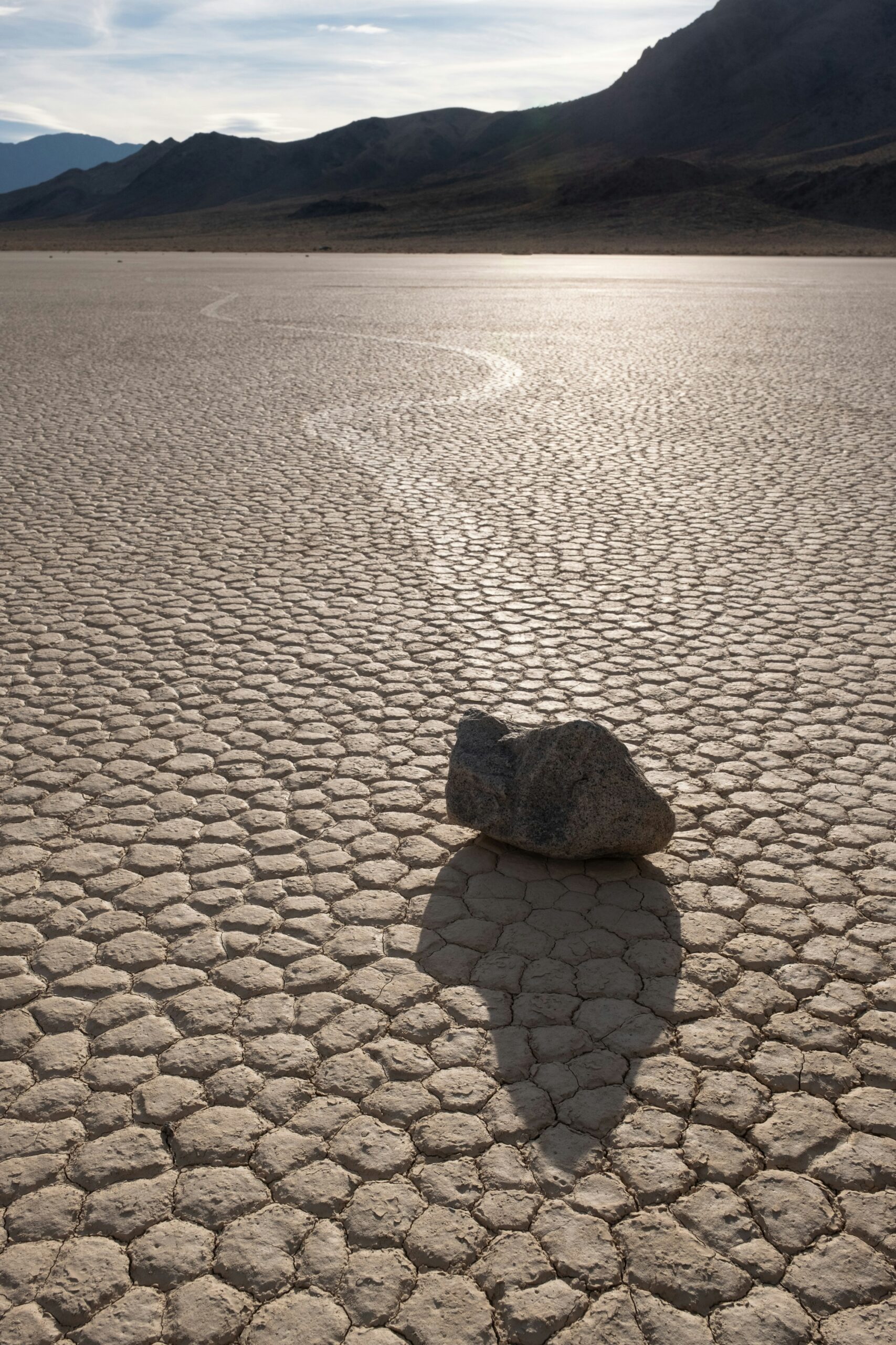
Death Valley National Park is the most extreme version of this landscape I visit regularly—salt flats, badlands, canyon narrows, all below sea level. I plan every trip there around the season and time of day, since the heat can be brutal if you don’t.
Plan Around Parks, Seasons, and Permits
Timing can make or break a California hike. I plan every trip around three things: park reservation systems, seasonal weather, and permit lotteries. Miss any of those, and the whole trip can fall apart before it even starts.
Yosemite National Park Reservations and Trail Access
I never just show up at Yosemite National Park without checking the reservation calendar. In peak season, you need a timed reservation to get in, and trailhead parking near Curry Village and Happy Isles fills up by mid-morning, even if you’ve got a pass.
Half Dome has its own system: a separate permit lottery controls access to the cables, and rangers do check for permits at the subdome. I apply months ahead, then watch the daily lottery for any last-minute luck.
Valley trails stay open all year, but snow and ice close the high-country routes like the John Muir Trail above 8,000 feet from about November through June.
Sierra Nevada Snow, Heat, and High-Altitude Windows
The Sierra Nevada has a short hiking season. High passes usually clear of snow by early July, but a heavy winter can push that into August.
Mount Whitney really drives home the altitude risk. Starting at Whitney Portal (8,365 feet), I gain over 6,000 feet before hitting the 14,505-foot summit, and altitude sickness can hit anyone over 10,000 feet—fitness doesn’t always help. I watch for headaches, nausea, and trouble sleeping, and I turn back if it gets worse. Sequoia and Kings Canyon have the same high-elevation issues, so I use the same acclimatization tricks there.
Coastal Weather, Tides, and Road Conditions
Coastal hiking is all about the tides, not the temperature. On the Lost Coast Trail, I bring a tide chart because some sections are only safe to cross near low tide—get it wrong, and you’re scrambling over boulders with the water coming in.
Highway 1 is its own wild card. Winter storms can trigger landslides and close stretches of the Big Sur corridor, so I always check Caltrans before committing to a coastal trip.
Fog’s another thing, especially north of San Francisco, where it can blanket the coast from June through August. If I want good photos, I plan hikes around midday when the fog usually lifts. The Channel Islands? That’s a different microclimate altogether—ferry schedules there depend on ocean conditions, not the roads.
Desert Hiking During the Cooler Months
I only hike Joshua Tree National Park and Death Valley National Park between October and April. Summer in Death Valley? Just brutal—120°F isn’t rare, and it doesn’t take long for heat exhaustion to sneak up on you out there.
Cooler months have their quirks:
- October–November: Days feel great, but late-season storms sometimes bring flash floods
- December–February: Nights get cold, especially if you’re up high in Joshua Tree
- March–April: Wildflowers pop if the rain’s been decent, and you’ll probably see more people
I always carry more water than seems reasonable in the desert. Dry air and wind dry you out fast, sometimes before you even realize it.
Wilderness Permits for Popular Overnight Routes
Every time I plan a multi-day trip through the Sierra wilderness, I grab a permit. For the John Muir Trail and Mount Whitney, I use the recreation.gov lotteries months ahead. But I don’t just rely on the lottery—I keep checking for cancellations as my dates get closer, since spots do open up.
The Pacific Crest Trail has its own long-distance permit for folks hiking 500 miles or more, which is a whole different system from the standard permits for shorter stretches in the Sierra.
Lassen Volcanic National Park and some less-crowded spots still want you to have an overnight permit. Even if the demand isn’t as wild as Yosemite or Whitney, I apply earlier than I think I need to. Quotas are strict, and rangers really do check at the trailheads.
Prepare for a Safe and Responsible Hike
Before I head out on any California trail, I double-check my gear, water, and permits to make sure they fit the terrain and season. I try to plan for wildlife, weather, and leave-no-trace habits—gotta keep these places good for whoever comes next, right?
Essential Gear, Water, and Navigation
I never trust my phone alone for navigation. Cell service drops off fast in the Sierra Nevada backcountry or along those lonely coastal trails, so I always throw a paper map and compass in my pack.
How much water I carry totally depends on the route. If I’m on a dry ridgeline, I carry extra. If I’m near creeks and lakes, I’d rather haul a filter than lug every ounce from the trailhead.
When I’m up high in the John Muir Wilderness or Inyo National Forest, I keep an eye out for altitude sickness—headache, nausea, trouble sleeping. If those hit, I don’t mess around; I just drop to a lower elevation.
My go-to gear list:
- Layered clothing for wild temperature swings
- Sun protection—hat, sunscreen, sunglasses
- A headlamp with spare batteries
- Basic first-aid kit
- Traction devices if there’s a chance of snow above treeline
Bear Safety and Food Storage
I treat a bear canister as non-negotiable for any overnight trip in the Sierra. Rangers at trailheads like Whitney Portal will actually check and turn you back if you don’t have one.
I stash all my food, trash, and anything scented in the canister every night, even if I’m just out for a quick trip. Bears here know the drill, and if they get used to finding food, it turns into a headache for everyone who comes after.
On the Lost Coast Trail, I keep the same routine. Black bears show up around campsites between Mattole Beach and Black Sands Beach, so I never leave food out, not even for a minute.
Weather, Tide, and Wildfire Checks
I check conditions the night before and again the morning I head out. California weather can flip fast, especially with elevation changes—sometimes the forecast barely scratches the surface.
When I’m hiking the coast along the Pacific Ocean, I always check tide charts before I leave. Some stretches of the Lost Coast only open up around low tide, so I plan my day around those windows, not my own pace.
In the Mojave Desert and other low desert spots, I steer clear of midday hikes in summer. Temps can blow past 110°F. If I’m near volcanic terrain like Lassen Peak, I also look out for lingering snowfields, since they can stick around deep into summer.
During fire season, I check for trail closures and air quality before I even think about driving to the trailhead.
Leave No Trace on California Trails
I stick to Leave No Trace principles every time I head out, whether it’s a short hike or a longer trek. That means I pack out all my trash—yes, even the food bits and toilet paper. Nobody wants to stumble on that stuff, right?
I make sure to walk on marked trails, especially in those delicate alpine meadows or sketchy hydrothermal spots. It’s wild how a single careless step can mess up terrain that’ll take ages to bounce back. Near those thermal pools or the boardwalks, I don’t take any chances—I just stay on the path.
When camping, I pick established sites if that’s what the area requires. I go with a bear canister for my food instead of hanging it, since it’s less hassle for the environment. If I run into wildlife, I keep my distance. No way am I feeding the animals, even if they look like they want a snack.


