Hidden Hikes in Santa Barbara County: Top Trails and Views
Santa Barbara County hides a handful of trails that most visitors never stumble upon. They're tucked into the Santa Ynez Mountains and Los Padres National Forest.
Lizard's Mouth, Tangerine Falls, Seven Falls, Inspiration Point, and Knapp's Castle—these are my picks for the best ocean and panoramic views in the region, minus the crowds you get at the usual spots. Each trail gives its own reason to ditch the coastline for a few hours.
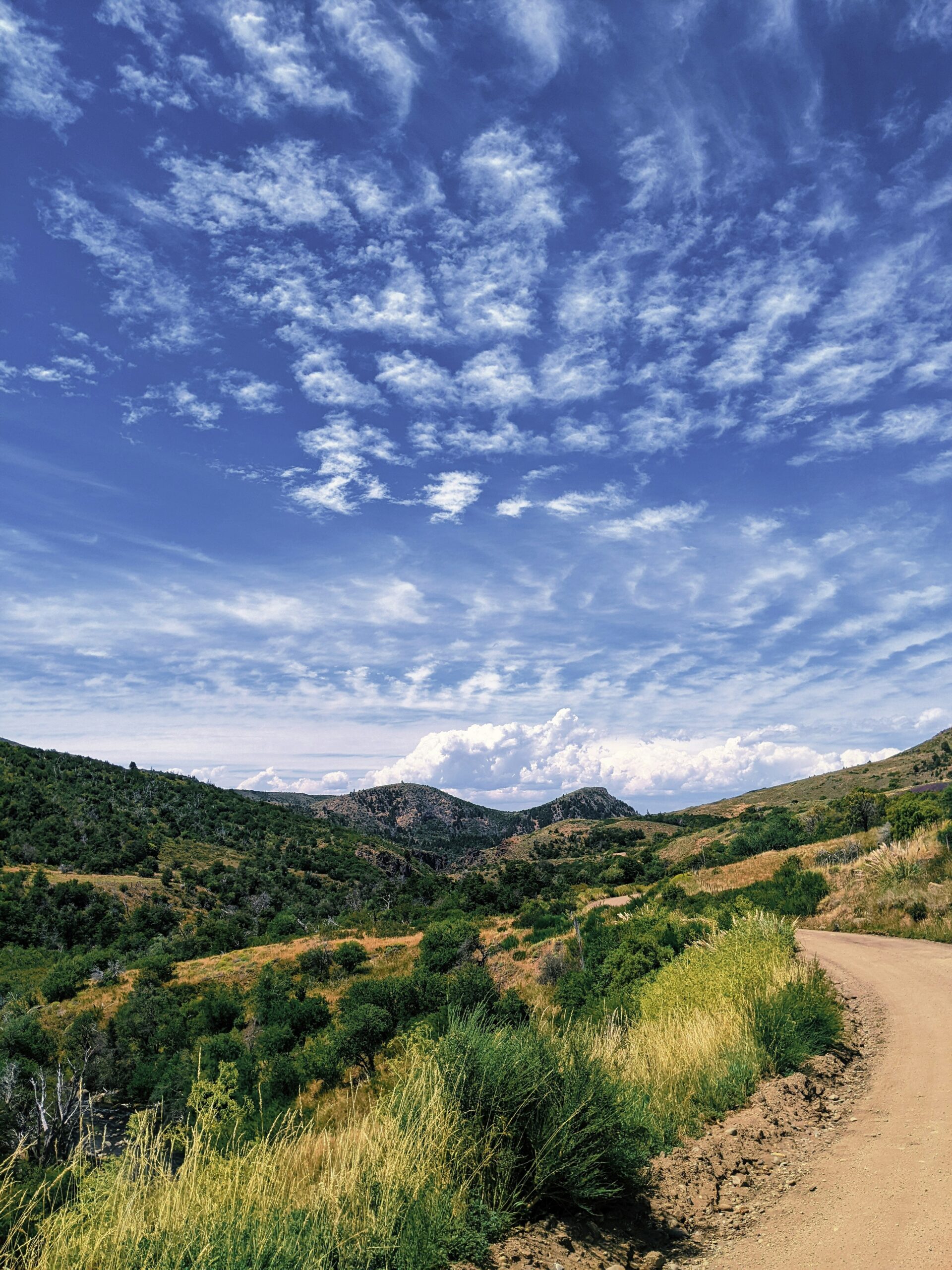
These central coast hikes go from quick scrambles to longer treks through creek beds and past old ruins. I've walked all five, and every one has its own vibe, from Lizard's Mouth's rock formations to the cascading pools at Seven Falls.
If you want a bit of history, some water, and a little elevation, these trails deliver—all without needing to set aside a whole day.
I put this list together because Santa Barbara's hiking scene deserves more love than it usually gets. Whether you're after a quick walk or a half-day adventure, these five hikes show a side of the area that's easy to miss if you stick to the main drags.
Hidden Hikes in Santa Barbara County: Top Trails and Views
Quick Trail Comparison and Planning Essentials
I've hiked these five trails more times than I can count, and honestly, they're all different in distance, difficulty, and what you get out of them. Here's how I pick the right trail, when I like to go, and a few logistics to consider before leaving Goleta, Montecito, or wherever you're starting from.
Choosing a Short Hike, Waterfall Route, or Summit Challenge
Not every hike here takes the same effort. I usually match the trail to my mood and how much time I've got.
| Trail | Distance | Difficulty | Best For |
|---|---|---|---|
| Lizard's Mouth | 1-2 miles | Easy | Short hike, rock formations |
| Inspiration Point | 3-4 miles | Moderate | Coastal views |
| Seven Falls | 3-4 miles | Moderate | Waterfall scrambling |
| Tangerine Falls | 4-5 miles | Moderate-Hard | Waterfall, creek crossings |
| Knapp's Castle (Currently closed to visitors.) | 2 miles | Easy | Historic ruins, quick payoff |
If I've only got an hour, I hit Lizard's Mouth or Knapp's Castle. For a full morning outdoors, Tangerine Falls or Seven Falls make me work for it.
Best Seasons for Water Flow, Wildflowers, and Clear Views
I aim for waterfall hikes between January and April, right after winter rains fill up the creeks at Seven Falls and Tangerine Falls. By late summer, they're usually dry or just a trickle.
Wildflowers hit their stride in March and April, especially near Lizard's Mouth and the open ridges off Camino Cielo Road. For those coastal views from Inspiration Point, I like fall mornings best—less haze, better light.
Knapp's Castle always comes through with good views, no matter the season or water flow.
Trailhead Access, Parking, and Current Conditions
I usually reach these trailheads from Highway 101 before heading up into the foothills above Santa Barbara. Lizard's Mouth and Knapp's Castle both require a drive up West Camino Cielo Road—there's not much parking, and no official lot.
Seven Falls and Inspiration Point trailheads sit inside Los Padres National Forest, so I check for fire restrictions and trail closures before I leave. Tangerine Falls, near Montecito, has barely any street parking—I show up early on weekends or risk circling the block.
I check county and forest service websites the morning of my hike since storms or fire can change things overnight.

Lizard's Mouth and Knapp's Castle Ridge Escapes
These two ridge spots give some of the best short hikes in the Santa Ynez Mountains. Minimal effort, big payoff. Both are close to Camino Cielo Road, so I sometimes pair them into one trip.
Finding Lizard's Mouth From West Camino Cielo
I always take West Camino Cielo Road to reach Lizard's Mouth. It's a winding ride along the ridge above Santa Barbara.
From Highway 154, I turn onto West Camino Cielo and drive for about 3.5 miles. The trailhead pops up on the left, just before the Winchester Canyon Gun Club. There's a wooden marker and a brown pipe on the ground—those are my landmarks for the Lizard's Mouth trail.
The parking area sits about 3.67 miles from Highway 154 along West Camino Cielo Rd. On weekends, I sometimes hear gunfire from the club—not my favorite soundtrack, but it fades as I hike.
Rock Formations, Optional Scrambling, and Sunset Views
Once I'm on the trail, I hit a cluster of sandstone boulders within a quarter mile. Lizard's Mouth Rock is the highest point, and honestly, it's probably the most popular bouldering spot in the area.
I can scramble over the rocks or just follow the trail as it loops around. If I climb onto the lizard-shaped outcrop, I get sweeping views of Goleta, the Pacific, and the Channel Islands. This is easily one of the best places in the county to watch the sunset from a rock perch.
Dogs are allowed here too, which I love, especially on quieter weekdays when the trail isn't crowded.
Exploring Knapp's Castle and Nearby Tequepis Trail
Update: Hikers are welcome to enjoy the scenic mountain ridge along the East Camino Cielo access trail. Please note that the stone castle ruins at the trail's end are located on private property. They remain closed to all visitors during active reconstruction.
Knapp's Castle is just a short drive from Lizard's Mouth along the same ridge. I treat it like a natural next stop.
The site preserves the stone ruins of an early 1900s estate that burned down ages ago. Arches and foundations scatter across the hillside. It's less than a mile round trip to see the ruins, and the ridge gives me clear canyon views.
If I want to go longer, I sometimes hop onto the Tequepis Trail. It climbs through the Santa Ynez Mountains toward Lake Cachuma. This route takes more effort than Lizard's Mouth, but I get a different look at the region's water supply and peaks.

Inspiration Point and Front-Country View Trails
Honestly, the front-country trails above Santa Barbara are some of my favorites. You get coastal views without needing to camp overnight. Two main approaches lead to Inspiration Point, and Rattlesnake Canyon works as a shaded backup when the sun's just too much.
The Tunnel Trail and Jesusita Trail Approach
I usually start at the Tunnel Trailhead off Tunnel Road. Parking lines the street on busy weekends, so I get there early if I can.
The trail climbs through Mission Canyon on a route that once carried water from the Santa Ynez River. After about a mile, I hit a junction where several paths meet, including the one toward Mission Creek.
From there, I take the narrower route up to the point. If I want to stretch things out, I sometimes pick the Jesusita Trail. It adds distance and elevation but gives a different look at the canyon before merging for the final climb to the summit.
Views From Inspiration Point
The top makes the climb worth it. The trail flattens out and suddenly the Santa Barbara coastline opens up below, with the Channel Islands visible on clear days.
The views stretch from the ocean up to the Santa Ynez Mountains behind me. If I look closely, I can spot the Santa Barbara Mission and surrounding neighborhoods too.
I like hiking here in the morning or late afternoon. The last stretch is exposed, and the light just works better for photos at those times.
Rattlesnake Canyon as a Shaded Alternative
When I want shade, I go for Rattlesnake Canyon, a 4.5-mile out-and-back with about 1,587 feet of elevation gain. It usually takes me close to three hours.
This trail stays open year-round and brings out hikers, runners, and horseback riders. Dogs on leash are welcome, which is great for me when I'm with friends and their pets.
Unlike Inspiration Point's exposed climb, Rattlesnake Canyon keeps me under tree cover most of the way. It's my go-to on hot days, no question.

Safety, Stewardship, and Responsible Route Finding
I've learned these hikes reward preparation. Creek crossings, loose rocks, and unmarked forks can turn a quick outing into a much longer one if I'm not careful.
I always check trail conditions before heading out and treat the terrain with respect.
Assessing Water, Heat, and Rock-Scrambling Hazards
Before I head to Seven Falls, I check recent rainfall totals. That trail follows Mission Creek and has a bunch of creek crossings that can get dicey after storms.
I never assume a pool is deep enough for jumping—silt shifts every year, and I always check the water before anyone slides off a ledge.
Rock scrambling on wet Coldwater Sandstone is sketchy. I wear shoes with real tread, never sandals.
Heat's a factor too. I carry more water than I think I'll need, especially on exposed stretches near Inspiration Point. That return climb feels a lot longer in the afternoon sun.
Navigating Unmarked Paths and Protecting Sensitive Areas
Some of these routes—like the approach to Tangerine Falls—wind along unmarked or barely maintained paths in Los Padres National Forest.
I stick to established use-trails instead of carving out new ones. Chaparral just doesn't bounce back quickly after it's been trampled.
At Knapp's Castle, I walk the clear footpath around the ruins. I don't climb on the old foundation stones—they're fragile, and honestly, they crumble a bit more every year.
I skip marking new trails with rock cairns or flagging tape. Markers tempt folks to wander off the main route, which speeds up erosion and just isn't great for the native plants along the creek.
If a side trail through the brush links back to the creek, I go with the route others have already worn in. No need to blaze a shortcut, right?
Parking Legally and Respecting Trail Closures
Parking tickets pop up a lot at trailheads like the one at the end of Tunnel Road. I always read the posted signs carefully and make sure I don’t block any driveways or fire lanes.
Honestly, I’d rather walk a little farther than deal with a ticket or, worse, getting towed.
Closures near Highway 101 access points or inside Los Padres National Forest usually happen because of fire restrictions or storm damage. I check current alerts before heading out, since nothing’s more annoying than showing up to find the trailhead closed—or realizing it’s closed for a good reason, like unstable slopes or washed-out sections.