Things to Do in Northern California: Best Places to Visit
Northern California stretches from rugged coastline to volcanic peaks, and honestly, after years of poking around up here, I still find new reasons to visit. The best places to visit in Northern California include Yosemite National Park, Lake Tahoe, the Redwoods, and the Pacific Coast Highway. Each spot has its own vibe, shaped by wild landscapes and ever-changing terrain. I think the region really shines when you blend the big names with a few off-the-beaten-path places you might not see on every travel list.

Beyond the usual landmarks, I’ve stumbled onto small towns, quiet beaches, and hidden corners of wine country that don’t get much press. These places paint a truer picture of what Northern California actually offers—geothermal oddities, old mining towns, and scenery that’s just a little out of the way. Honestly, the most beautiful places up here often hide just off the main road, waiting for anyone willing to take a slight detour.
This guide covers the things to do in Northern California that I think are actually worth your time, broken down by category so you can plan around what you’re into. Outdoor adventure, coastal towns, vineyards north of San Francisco—whatever you’re after, I’ve tried to lay out what makes each area special and why it deserves a spot on your list.
Things to Do in Northern California: Best Places to Visit
How to Choose Your Northern California Destination
I usually pick my destination based on three things: the season, how much time I’ve got, and whether I’m craving coastline, mountains, or wine country. Once I figure out those basics, the rest of my northern California itinerary just sort of falls into place.
Best Picks for First-Time Visitors
If I’m heading up for the first time, I start with San Francisco. It’s the obvious gateway to the Pacific coastline, cool old neighborhoods, and quick day trips into wine country.
From there, I usually drive up to Napa or Sonoma for a day or two of wine tasting and those classic vineyard views.
I try to squeeze in a stop in the redwoods too—towering ancient trees are just part of the Northern California DNA, and this list of things to do in Northern California agrees.
If I’ve got more time, I tack on Lake Tahoe to get a taste of the Sierra Nevada mountains. That combo gives me city, coast, wine, and mountains without endless hours behind the wheel.
Best Seasons for Coast, Mountains, and Wine Country
I time my trips around what I want to see most, since every region peaks at a different season.
| Region | Best Season | Why |
|---|---|---|
| Coast | Late summer to early fall | Less fog, clearer views |
| Wine Country | September–October | Harvest season, mild temperatures |
| Sierra Nevada | June–September | Snow-free trails, open roads |
I skip the coast in early summer—fog just takes over. For wine country, I’m all about fall instead of spring, since harvest season brings a buzz you can actually feel, and you’ll see this in any good roundup of Northern California destinations. If I’m itching for a California road trip through the mountains, I wait for the snow to melt high up.
How Much Time to Allow for Each Region
I never do San Francisco in less than two full days—gotta have time for the city and those quick escapes.
One or two days in wine country is plenty for a few wineries and some downtime.
The coast? If I want to drive Highway 1 and hit the scenic stuff, I give myself two or three days.
Lake Tahoe and the Sierra Nevada deserve three days minimum, especially if I plan to hike, kayak, or bounce between trailheads. When I try to hit everything in one go, I block out a week or more—usually seven to ten days, which is about what’s suggested in this 7-day Northern California itinerary.
Yosemite and the Sierra Nevada
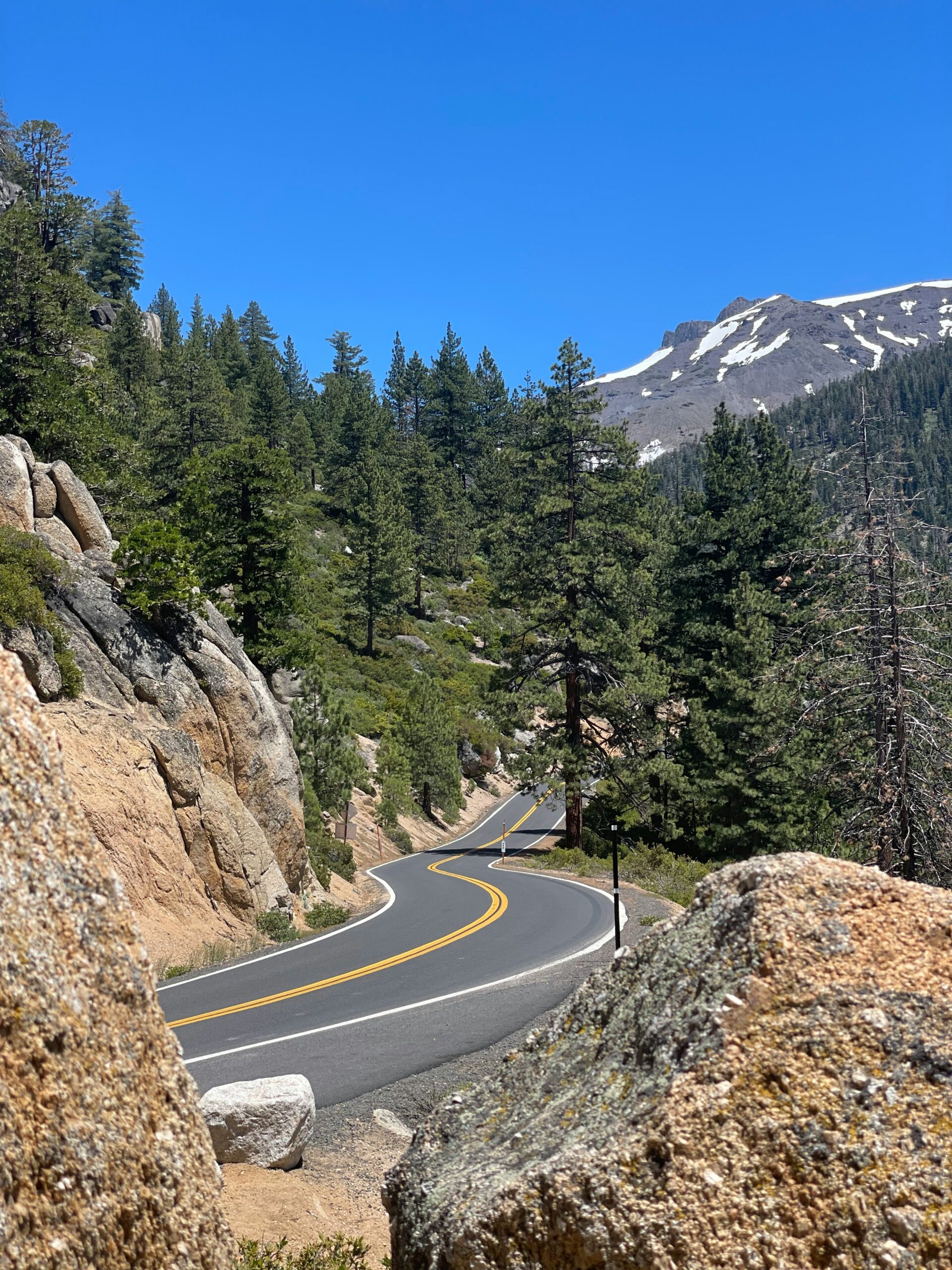
The Sierra Nevada mountains cut across eastern California, and right in the heart of it is Yosemite National Park—probably the most iconic landscape in the state. I’ve wandered around this region enough to know that granite peaks, ancient sequoias, and crystal-clear alpine lakes give the Sierra Nevada a totally unique flavor.
Yosemite Valley's Signature Viewpoints
Yosemite Valley is the classic starting point, and I always tell people to kick things off at Tunnel View. You get El Capitan, Half Dome, and Bridalveil Fall all in one epic shot.
Valley View, down along Southside Drive, gives you a lower perspective with the Merced River out front. I usually find it less crowded than Tunnel View, especially if I roll in early.
Cook's Meadow has a wide, flat angle on Yosemite Falls and Half Dome. The walk’s easy, so it’s a solid pick if you’re not looking to hike deep into the park.
Half Dome, El Capitan, and Yosemite Falls
Half Dome towers over the eastern side of the valley, and if you’re thinking of climbing it, you’ll need a permit and a lot of stamina—the hike runs 14 to 16 miles round-trip, with cables near the top. I only recommend this one if you’re in good shape and not scared of heights.
El Capitan, that 3,000-foot wall of granite, draws climbers from all over. I’ve watched them inch up the face for days, looking like tiny dots from the valley floor.
Yosemite Falls—tallest in North America—cranks up in spring and usually peaks in May. By late summer, it can slow to a trickle or just dry up.
Glacier Point and Giant Sequoias
Glacier Point, at 7,214 feet, gives you one of the best views in Yosemite—straight out over Half Dome, the valley, and the high country. The road up there closes in winter when snow piles up.
The Mariposa Grove is packed with over 500 mature giant sequoias. The Grizzly Giant, which is over 1,800 years old, stands out among the biggest in the grove.
Sequoia National Park further south has the largest sequoias by volume, but Mariposa Grove gets you up close without the long haul.
Mono Lake and Mammoth Lakes
Mono Lake, out on the eastern side of the Sierra, is famous for its tufa towers—those weird, spiky formations built up by underwater springs. The lake doesn’t drain anywhere, so over thousands of years, it’s gotten super salty.
Mammoth Lakes sits about two hours from Yosemite Valley if you take Tioga Pass. I head there for hiking, fishing, and the Ansel Adams Wilderness. But heads up—Tioga Pass closes for snow, usually November through late May, so you can’t always get through.
Both Mono Lake and Mammoth Lakes make great add-ons to a Yosemite trip if you want to stretch out your Sierra Nevada adventure. There’s more on that in this Sierra Nevada travel guide.
Lake Tahoe's Alpine Escapes
Lake Tahoe is the biggest alpine lake in North America, and I honestly haven’t found anywhere else in Northern California that hits the same mix of clear water, granite peaks, and year-round fun. Every season has its own thing—summer for paddling, winter for skiing, you get the idea.
Emerald Bay and South Lake Tahoe
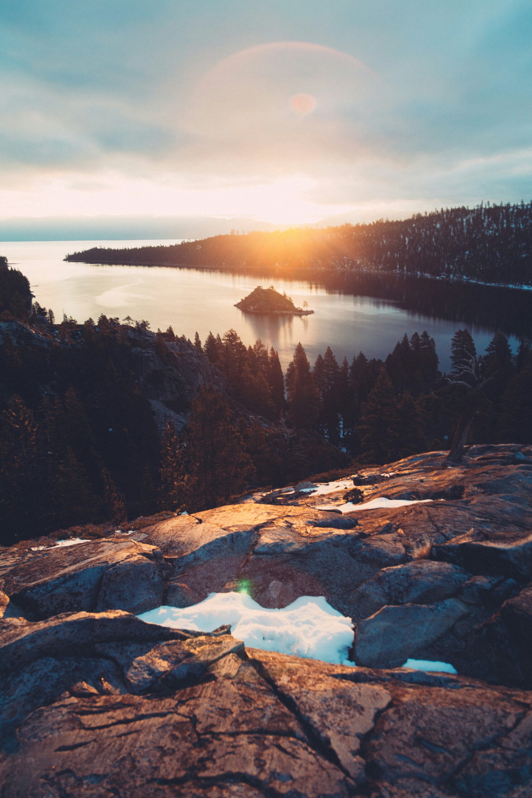
Emerald Bay is hands-down the most photographed spot on the lake. The turquoise water, pine-covered cliffs—it’s just wild. Emerald Bay State Park lets you check out Vikingsholm, a Scandinavian-style mansion from 1929, and Fannette Island, the lake’s only island.
I usually hike down from the Eagle Falls trailhead, but the climb back up is no joke. South Lake Tahoe is my usual base—casinos, restaurants, and hotels just across the Nevada line.
From town, I can hit a bunch of beaches with just a short drive. Plus, I’m close to Heavenly Ski Resort, which I visit in both summer and winter for the gondola rides and those mountain views.
Summer Kayaking and Paddleboarding
When I’m at Tahoe in summer, I always rent a kayak or paddleboard. The water stays cold but it’s calm in the mornings. Emerald Bay is perfect for paddling—you can hug the shoreline, sneak over to Fannette Island, and dodge the big boats if you go early.
Up on the North Shore, I’ve done clear kayak tours that let you peer straight down into the lake. Kings Beach and Commons Beach in Tahoe City are my favorite paddleboarding spots—flat launches and easy rentals make it simple.
I always check the wind before heading out, since afternoons can get pretty gusty and make paddling a real workout.
Winter Skiing and Snow Activities
Once the snow falls, usually by late November, I swap the paddleboard for skis. Heavenly, Palisades Tahoe, and Northstar California are my go-tos—each one has a mix of groomers and steeper runs, so you can pick your challenge.
I’ve also spent days at smaller spots like Sugar Bowl and Granlibakken when I want a break from the crowds. For cross-country, Royal Gorge is tough to beat—almost 100 groomed trails, and it’s the biggest around.
When I skip the slopes, I still find plenty to do—ice skating, snow tubing, or just wandering around the lake with a hot drink in hand. Not a bad way to spend a winter day, honestly.
Redwood Forests and Far-North Parks
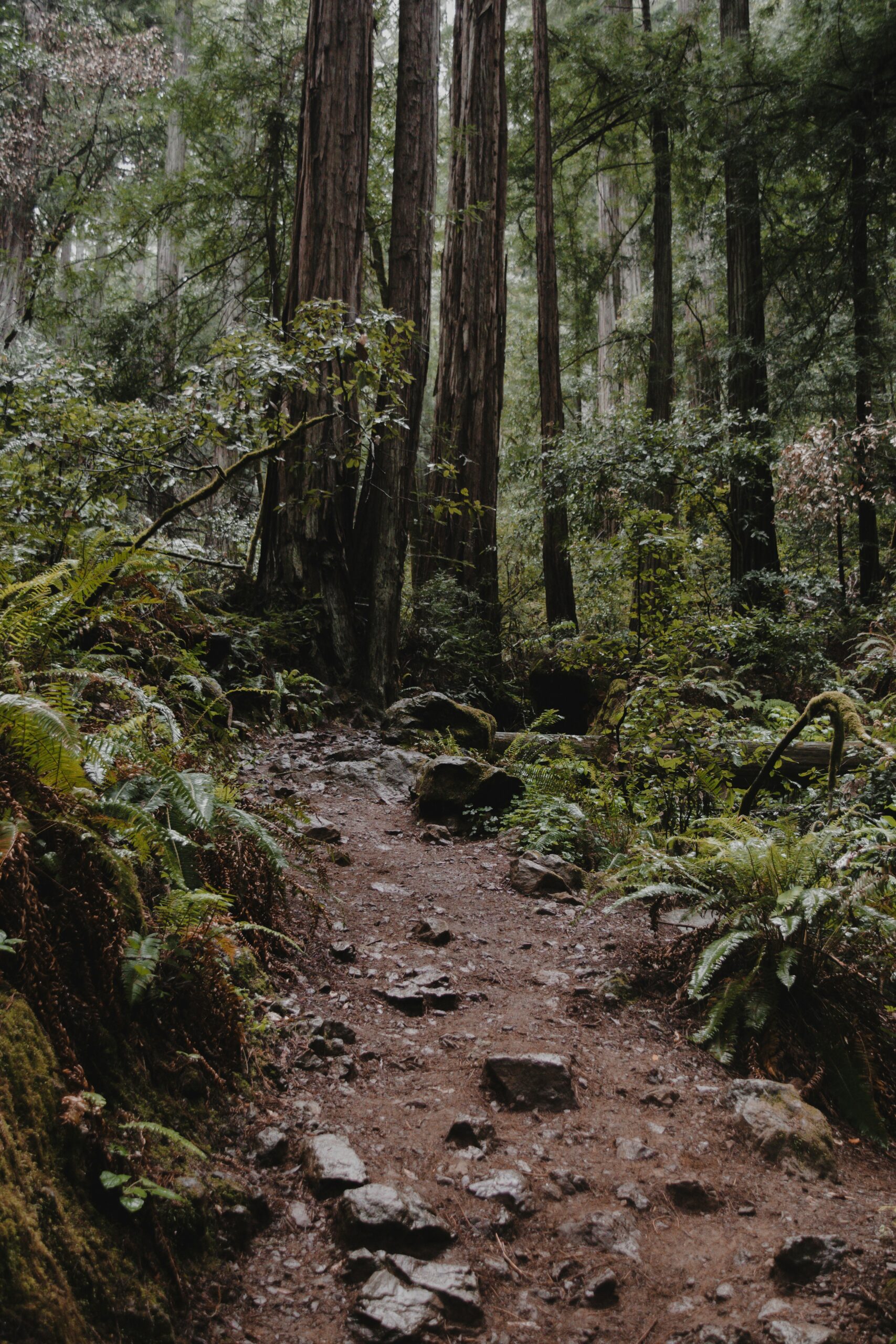
Northern California's far north holds the tallest trees on Earth, and after plenty of time under their canopy, I have a few favorite spots. Between ancient groves, ferny canyons, and the working port city that anchors the region, this coast rewards anyone willing to drive a few extra hours past San Francisco.
Redwood National and State Parks
This park complex blows me away every time. Four parks team up here, managed by both the National Park Service and California State Parks, protecting a huge chunk of the remaining old-growth coast redwoods.
The trees soar over 300 feet, and standing next to one, you get humbled fast. If you want a taste of the forest without a long hike, drive the Newton B. Drury Redwood Scenic Parkway.
With 10-plus must-see spots scattered about, I'd try to spend a full day here if you can swing it.
Avenue of the Giants and Humboldt Redwoods State Park
This 31-mile stretch of old highway runs parallel to Highway 101, and honestly, it’s the best drive in the redwood region. It slices through Humboldt Redwoods State Park, home to one of the world’s largest stands of ancient coast redwoods.
Founders Grove is my go-to stop—flat, easy, and you’ll stand face to face with some of the park’s oldest trees without breaking a sweat.
If you’re short on time, this is the one stop I wouldn’t miss.
Fern Canyon and Lady Bird Johnson Grove
Inside Prairie Creek Redwoods State Park, these two spots couldn’t feel more different, and I like squeezing both into the same day.
Lady Bird Johnson Grove is a 1.5-mile loop through a ring of redwoods. It's one of the easier hikes in the park if you want big trees minus the big effort.
Fern Canyon takes more commitment. The full loop is about 9 miles and drops you into a 50-foot canyon with fern-lined walls. I found it strange and beautiful—definitely worth the extra miles.
Eureka and the North Coast
I usually base myself in Eureka when I’m exploring this stretch. It’s the biggest city up here, so you get real restaurants and places to stay, but you’re still close to the forests.
The Carter House Inns surprised me with a wine list of over 3,800 bottles. For something different, hop on Eureka’s Madaket for a sunset bay cruise—the tiniest licensed bar in California floats right on board.
Outside Eureka, I always try to squeeze in a walk at Trinidad’s Moonstone Beach or Agate Beach—both are solid for a coastal break between forest hikes.
The Pacific Coast From Monterey to Mendocino
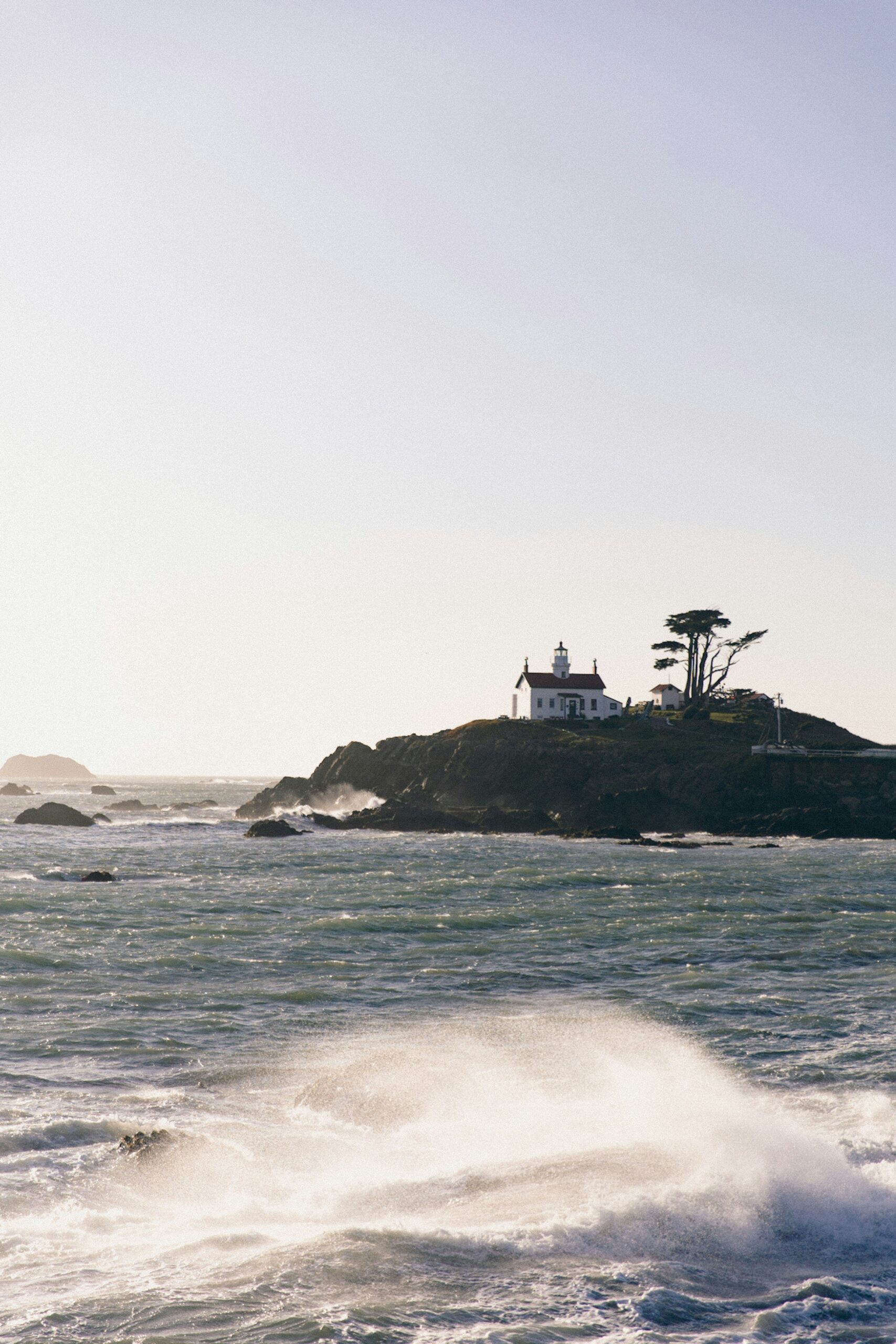
This stretch of coastline just might be the most rewarding drive in California. You get marine wildlife, dramatic cliffs, and quirky towns—each one with its own vibe. There’s a mix of easy stops and quieter places if you’re up for wandering a bit off the main drag.
Monterey Bay and the Monterey Bay Aquarium
Monterey Bay is a marine sanctuary, and honestly, the wildlife is everywhere. Depending on the season, I’ve watched sea otters, sea lions, and even migrating whales right from shore.
The Monterey Bay Aquarium sits right on the water, focusing on local species. Its kelp forest tank is massive—one of the tallest in the country. I always try to catch feeding time when I go.
Afterwards, I like to drive the 17-Mile Drive, which winds past cypress trees, golf courses, and rocky viewpoints. It links up with Carmel-by-the-Sea, a tiny town with galleries and a walkable downtown that’s perfect for an afternoon wander after the coast.
Santa Cruz Surfing and the Beach Boardwalk
Santa Cruz has a deep surfing history, and I think it’s one of the best places to watch—or try—the sport. Steamer Lane is a classic break, and I’ve spent plenty of time just watching surfers tackle those waves.
The Santa Cruz Beach Boardwalk is the state’s oldest seaside amusement park. Its wooden coaster and arcade games give the place a nostalgic, slightly faded charm that I love.
Whale watching tours leave from the harbor, and I’ve spotted gray whales during migration. Even outside peak season, the bay’s rich waters make boat tours worthwhile—there’s always something out there.
Big Sur, Bixby Bridge, and Highway 1
Once you hit Highway 1 through Big Sur, the cliffs get wild. Steep drops, endless ocean, and those classic pullouts with jaw-dropping views—it’s hard to beat.
Bixby Bridge is the spot everyone photographs, and I always slow down for the viewpoint just north of it. The arched concrete design frames the coast in a way that’s become iconic on the Pacific Coast Highway.
When I need a break from driving, Pfeiffer Big Sur State Park is my pick for redwoods and river access. The Valley View Trail is a short hike with a surprisingly good overlook.
Mendocino, Fort Bragg, and Glass Beach
Mendocino sits high above the Pacific, and its New England-style buildings always catch me off guard—feels out of place for California, but in a good way. The town is tiny and walkable, with bakeries, galleries, and those ocean bluffs all close together.
Just up the road, Fort Bragg has a working-class past—logging and fishing, mostly. I usually stop for seafood before heading farther up the Northern California coast.
Glass Beach in Fort Bragg is a former dump site where waves turned old glass into smooth, colorful pebbles. I always tell people—don’t take the glass. Leave it for everyone else to see.

San Francisco and Bay Area Highlights
San Francisco really anchors Northern California travel. Its neighborhoods, waterfront, and nearby nature spots pack a lot into a small area. From the Golden Gate Bridge to the redwoods north of the city, you can squeeze in a lot in just one day.
Golden Gate Bridge, Golden Gate Park, and Sausalito
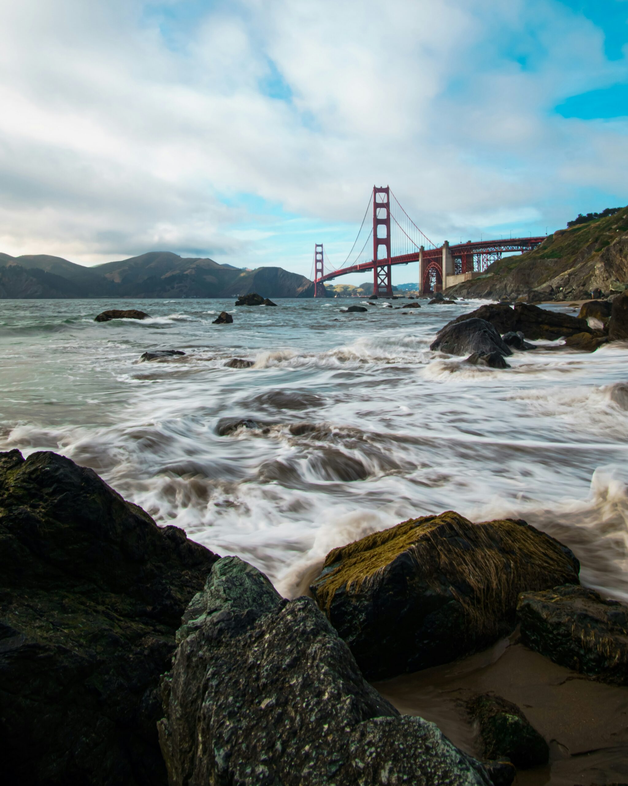
Start with the Golden Gate Bridge—no question. It’s one of the most recognizable landmarks in the country. Walking or biking across gives you open views of the bay, the city, and the Marin Headlands.
Golden Gate Park stretches inland for over 1,000 acres. Inside, you’ll find the Japanese Tea Garden, the de Young Museum, and the California Academy of Sciences.
Sausalito is just across the bridge and always feels relaxed to me. Its waterfront houseboats, small galleries, and bay views make it a good stop, and it ties in nicely with a bigger look at Northern California’s best natural wonders.
Alcatraz Island, Fisherman's Wharf, and Pier 39
Alcatraz Island sits out in the bay and used to be one of the country’s most secure prisons. I always book a ferry ticket ahead—spots fill up fast.
The audio tour covers the prison’s history, famous inmates, and escape attempts. Ferries leave from Fisherman’s Wharf, which I think is worth a stop for seafood and harbor views.
Pier 39 is nearby and known for its sea lions, which sprawl on the floating docks. Shops and restaurants line the pier, so you can easily combine it with a wharf visit in an afternoon.
Chinatown and the Mission District
San Francisco’s Chinatown is the oldest in North America, and its narrow streets, herbal shops, and dim sum spots really show off its history. Grant Avenue and Waverly Place have great architecture and street-level details.
The Mission District feels totally different—murals, taquerias, and indie bookstores everywhere. Balmy Alley and Clarion Alley are packed with outdoor murals.
I always end up eating in the Mission. The bakeries and taco shops reflect the neighborhood’s deep Latino roots.
Muir Woods National Monument
Muir Woods National Monument is about 12 miles north of San Francisco and protects one of the last old-growth redwood forests in the Bay Area. Some trees top 250 feet, and a few are over 500 years old.
The Main Trail Loop is paved and easy—great for a walk through the forest floor. Parking’s tight, so I always reserve a spot or take the shuttle, especially on weekends.
Fog often lingers in the mornings, giving the place a quiet, layered feel. I’d pair Muir Woods with a stop at Muir Beach or Stinson Beach to round out the trip—makes for a solid half-day and fits well into broader Northern California road trips.
Wine Country and Relaxing Getaways
Northern California’s wine region is about more than just tasting rooms. I’ve found that mixing a day of wine tasting with a soak in a hot spring or a stroll through a historic plaza gives you a fuller sense of the area.
Napa Valley Wineries and Wine Tasting
Napa Valley is still my top pick when I want polished tasting rooms and those big-name wines everyone talks about. These days, I usually have to reserve tastings ahead of time—most wineries want appointments and don't really do walk-ins anymore.
If I'm not in the mood for the crowds along the Silverado Trail, I’ll slip over to the Coombsville AVA. It’s a quieter spot with some seriously good Cabernet Sauvignon and Chardonnay. I’ve had some of my favorite tastings in cave rooms and small, family-run vineyards over there.
Some things I keep in mind before heading out:
- Tastings usually cost $20–$60 per person
- Mornings or late afternoons are way less crowded
- Some places waive the fee if you buy a bottle
- I always double-check food and pet policies before I go
Sonoma County and Sonoma Plaza
To me, Sonoma County just feels more relaxed and spread out than Napa. You get more variety in the wines, and honestly, prices are better for what you get. Sonoma Plaza is usually my first stop—it’s got shops, restaurants, and a bunch of tasting rooms, all within a few blocks.
When I want to dodge the touristy Healdsburg scene, I’ll head out to the backroads of West Sonoma. There are tiny producers out there, tucked near Forestville and along the Gravenstein Highway, pouring sparkling wines and small-batch Pinot Noir without the long waits you get closer to the plaza.
I try to squeeze in a walk through Armstrong Redwoods State Natural Reserve too. It’s an easy way to reset between tastings.
Calistoga Hot Springs and Spa Stays
After a day of tasting, Calistoga is where I go to slow down. The town sits at the north end of Napa Valley and is famous for its natural hot springs and geothermal mud baths.
I’ve tried a few different local spas—most use the area’s volcanic ash and mineral water. I’m a sucker for a mud bath followed by a soak in a hot mineral pool. That’s become my go-to routine whenever I’m in town.
Calistoga still feels like a small town to me. Main Street has just enough independent restaurants and tasting rooms to make it easy to unwind with a glass of wine before heading back to wherever I’m staying.

Volcanoes, Waterfalls, and Geological Wonders
Northern California sits right on top of active volcanic terrain, and I’ve found the geothermal activity, lava formations, and all that dramatic water are some of the most striking landscapes in the state. Every site below has its own personality, from steaming vents to deep caves carved by lava.
Lassen Volcanic National Park and Lassen Peak
Lassen Volcanic National Park is one of those rare places where you can spot all four volcano types—shield, plug dome, cinder cone, and composite—without leaving the park.
Lassen Peak stands out as a huge lava dome volcano. Its last eruption was in 1915, and ash traveled as far as 200 miles east.
If you want to get up close, the Lassen Peak Trail is the move. It’s about 5 miles round trip, with a 2,000-foot climb, and the summit views are worth every step.
From up top, I can usually see the surrounding cinder cones and, if it’s clear, even Mount Shasta in the distance.
Bumpass Hell and Geothermal Features
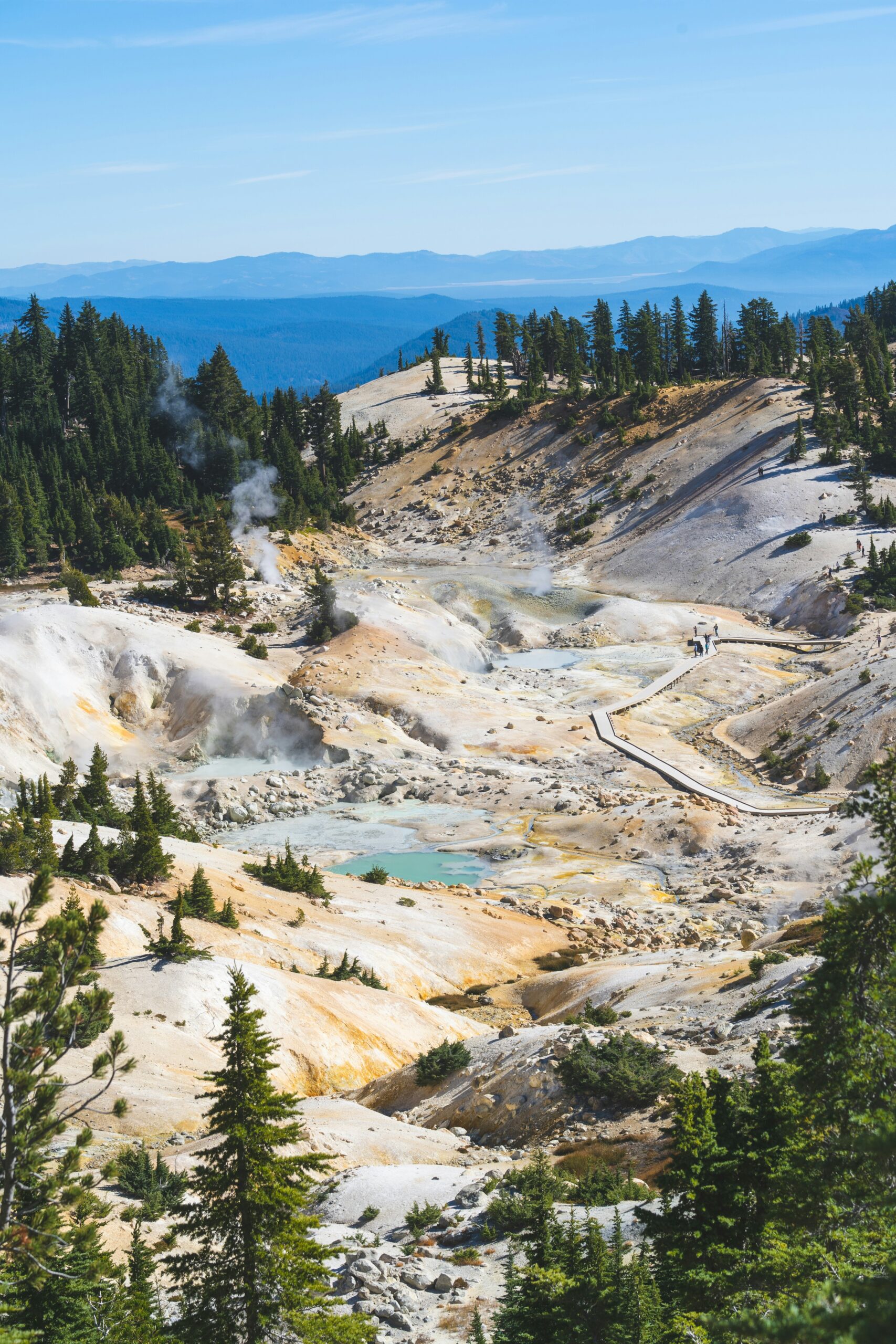
Bumpass Hell is the park’s biggest hydrothermal area, and in my opinion, it gives you the best sense of what’s bubbling away beneath the surface.
The 3-mile roundtrip trail takes you to a boardwalk right over the geothermal basin. Once I’m there, I usually spot:
- Boiling mud pots
- Steaming fumaroles
- Bright blue-green hot springs
- Sulfur-crusted vents
Some of the pools are almost boiling, so I don’t step off the marked boardwalk—ever. The sulfur smell hits me well before I get to the main basin. It’s a strong reminder that this place is still very much alive, geologically speaking.
Lava Beds National Monument and Lava Tube Caves
Lava Beds National Monument is easily one of the most unusual spots I’ve explored in Northern California, shaped by thousands of years of volcanic flows from the Medicine Lake shield volcano.
There are over 800 lava tube caves here, and I can wander through about two dozen of them without needing a permit. These tubes formed when the outer parts of a lava flow cooled and hardened while the inside kept moving, leaving hollow tunnels behind.
I always bring a flashlight and sturdy shoes—these caves are dark and the ground’s uneven. Some, like Catacombs, mean crawling through tight spaces, while others, like Golden Dome, are roomy enough to walk upright.
McArthur-Burney Falls
Burney Falls might be the most photogenic waterfall in California, sitting inside McArthur-Burney Falls Memorial State Park.
The falls drop 129 feet, but what really gets me is how the water just pours out of the cliff itself—from springs and seepage in the basalt, all fed by an underground aquifer.
This steady, spring-fed flow means the falls never really dry up, even in the hottest months. I like to take the half-mile loop trail for different views, and the surrounding forest of Douglas fir and incense cedar makes the whole scene feel tucked away.
Historic Cities and Gold Rush Stops
The gold rush era still shapes so much of what I stumble across in Northern California’s historic districts. Riverboat towns, quirky mansions, and all sorts of 19th-century leftovers connect today’s travel with the past.
Sacramento's Old Sacramento Waterfront
I always start Sacramento trips at Old Sacramento, a 28-acre historic district right on the river. The wooden boardwalks and old brick storefronts take me straight back to the gold rush days, when Sacramento was a key supply stop for miners heading into the hills.
I walk the cobblestone streets and check out shops in buildings from the 1850s and 1860s. Some buildings sit higher than they did originally—Sacramento raised street levels after floods wiped out ground-floor businesses one too many times.
If you’re into river history, a riverboat cruise on the Sacramento River is worth timing your visit around. There are restaurants and little museums all over the district, so I can hang out for hours without needing to leave.
California State Railroad Museum
The California State Railroad Museum has to be one of the best train museums in the country. It’s right at the edge of Old Sacramento, so I never end up walking far to get there.
Inside, I find more than 20 restored locomotives and railcars, including old steam engines that once pulled freight and passengers across the Sierra Nevada. The exhibits do a great job showing how the transcontinental railroad connected California to the rest of the country—something that came right out of the gold rush boom.
I like to ride the seasonal excursion train from the museum’s depot for a little taste of old-school rail travel. Even if you’re not a train buff, the interactive displays keep things interesting.
San Jose and the Winchester Mystery House
San Jose makes my gold rush-era list mostly for its early California roots, but let’s be honest—the Winchester Mystery House is what really draws me in. It’s famous for its bizarre architecture and all the rumors swirling around its history.
Sarah Winchester, widow of the guy behind Winchester rifles, started building the house in 1884. She kept construction going for 38 years straight. Now it’s a 160-room Victorian mansion packed with oddities: staircases to nowhere, doors into walls, and windows in the floor.
I always take a guided tour—otherwise, there’s no way to see the weirdest rooms. The legend says Sarah Winchester believed nonstop building would keep spirits away, but I’m not sure I buy that. Still, it adds to the house’s mystique.
Gold Rush History Beyond the Major Cities
Honestly, some of the best gold rush history lives in the small towns along Highway 49, often called the Golden Chain Highway. Towns like Placerville, Sutter Creek, and Coloma keep their mining-era buildings, mine tours, and little museums focused on the 1848 gold discovery that started it all.
I head to Nevada County, El Dorado County, and Amador County when I want to see gold rush landmarks packed into a small area. You’ll find old mining camps, historic courthouses, and general stores that make it easier to imagine daily life back then.
I also like stopping in towns like Dunsmuir, where Victorian-era architecture pops up outside the core gold country region. If I’ve got the time, I’ll plan a longer route through multiple gold rush towns just to compare how each place keeps its history alive.

Scenic Road Trips and Lesser-Known Detours
I’ve pieced together a bunch of Northern California routes that mix the big-name stops with quieter backroads most travelers don’t even notice. Whether I’ve got a week or two, the region really pays off if you take it slow—especially along the coast and up in the mountains.
A One-Week Coastal and Mountain Route
For a one-week road trip, I like to use Highway 1 and some forest roads to get both ocean views and mountain air. I’ll head out from San Francisco, drive north on the Pacific Coast Highway toward Point Reyes and Mendocino, and pull over at random overlooks just to watch the cliffs drop into the ocean.
Then I cut inland for the redwoods near Humboldt—roads get narrower, trees close in overhead, and suddenly you’re in a different world. I’ll loop through Shasta-Trinity National Forest before making my way back south.
This route works best in late spring or early fall, when the weather’s good and the crowds have thinned out. It definitely makes those winding coastal stretches more enjoyable.
A Two-Week Northern California Loop
With two weeks, I like to push my California road trip east into wine country and the Sierra Nevada before looping back to the coast. I usually start out in Napa and Sonoma for the first few days, then drive over to Sacramento, and keep heading east toward Yosemite and Lake Tahoe.
After Tahoe, I make my way north to Lassen Volcanic National Park, then veer toward Burney Falls and Lava Beds National Monument up near the Oregon border. The last stretch takes me west through Redwood National Park, and finally I follow the coast south, rolling back into San Francisco.
This route clocks in at around 1,520 miles, and the full northern California itinerary takes about 32 hours of total driving time if I don't get sidetracked. I treat that number more like a suggestion than a rule—let's be honest, detours are half the fun and always seem to sneak in.
Point Reyes Wildlife and Lighthouse Detour
I never skip Point Reyes National Seashore when I'm heading north from San Francisco. The peninsula is just about an hour from the city, so it's an easy half-day or full-day detour off Highway 1—kind of a no-brainer.
The Point Reyes Lighthouse always pulls me in. I walk down those 300-plus steps to get there, and the views over the Pacific totally justify the climb back up (even if my legs complain).
Nearby, I like to swing by the elephant seal overlook at Chimney Rock, especially between December and March when the seals crowd the beaches to breed. I keep an eye on the tide charts before I go, since low tide usually means better tide pool exploring along the shore.
Practical Road Conditions and Reservation Tips
I always check road conditions before driving sections of Highway 1, since landslides and seasonal closures happen along the cliffside stretches. Caltrans posts updates online, and I usually pull them up the morning of any coastal drive.
National and state parks along these routes fill up fast—I've learned to book campground reservations or lodging weeks ahead, especially for Yosemite and Point Reyes once summer hits.
Here are a few habits I've picked up on every trip:
- Fuel up before remote stretches — gas stations pretty much vanish between coastal towns and those deep inland forests.
- Download offline maps — cell service just drops out in canyons and along most of the northern coast.
- Pack layers — coastal fog and mountain elevation changes can make the temperature swing wildly in a single day.
- Confirm park entry requirements — some areas ask for timed-entry permits during peak season, and it's easy to forget until you're at the gate.


